 |
|
|
|
Methodology____________
|
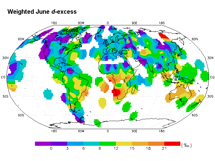
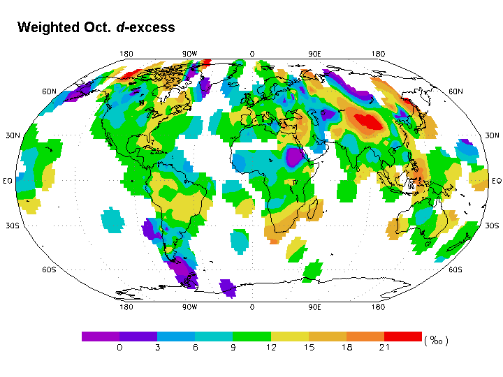
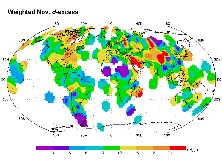
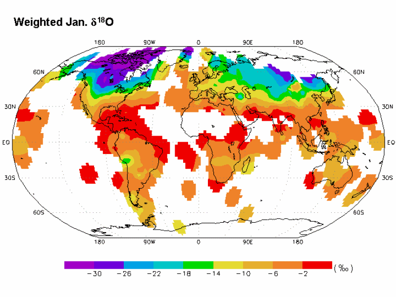
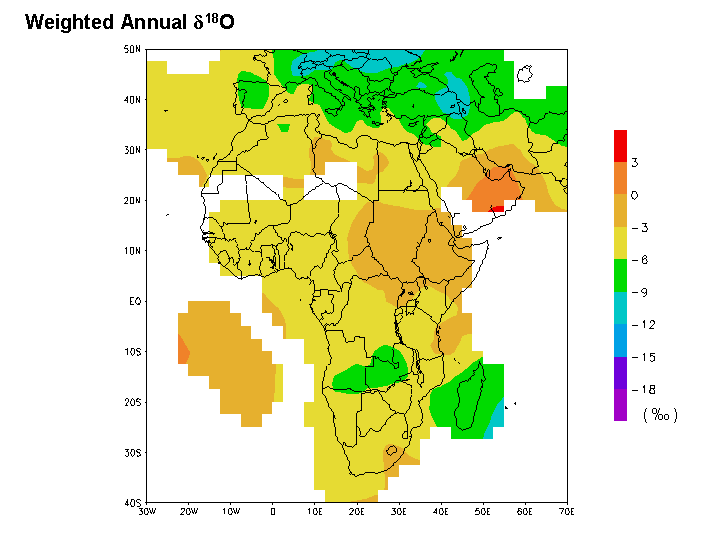
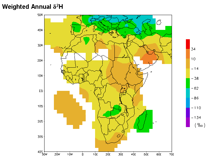
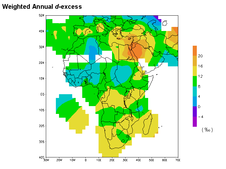
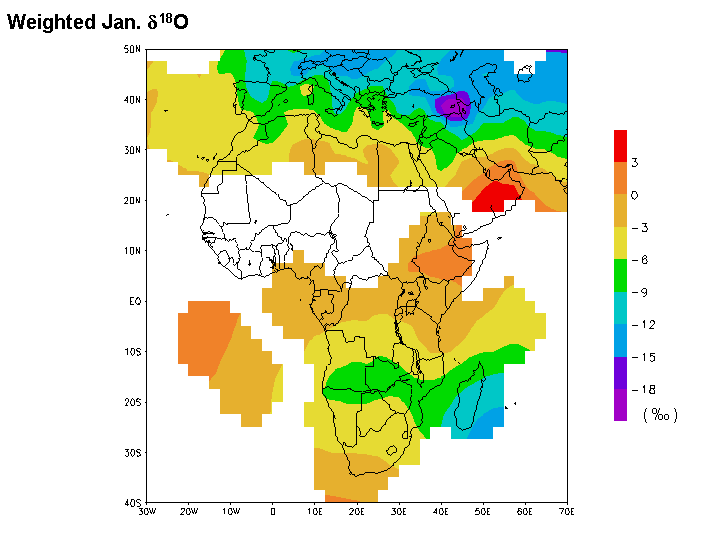
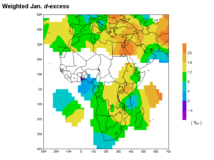
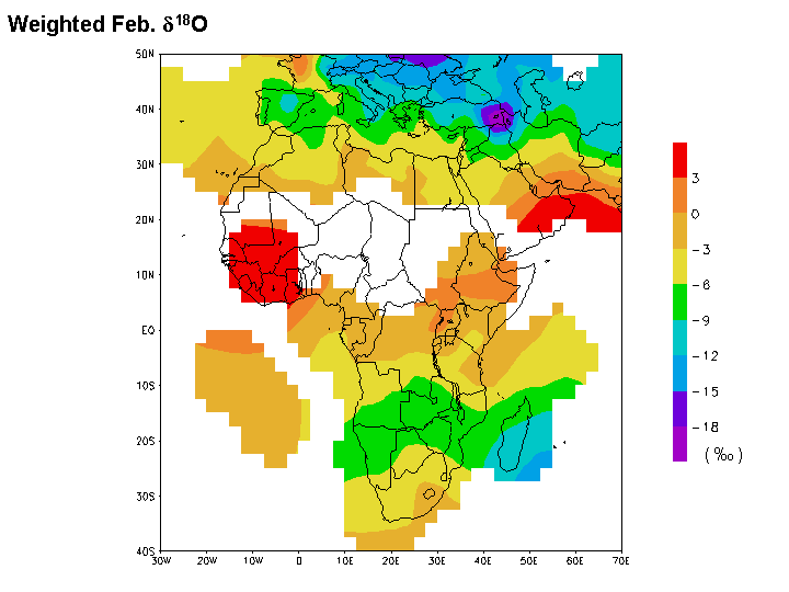
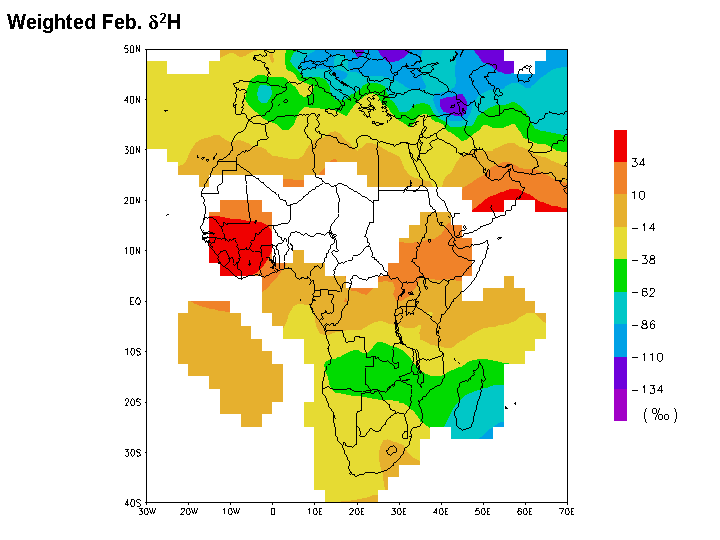
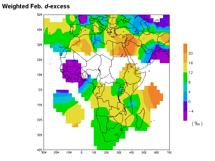
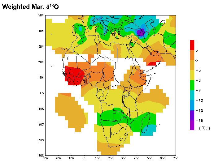
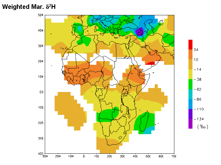
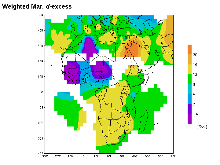
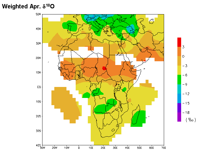
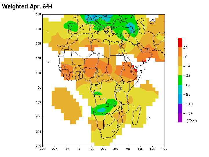
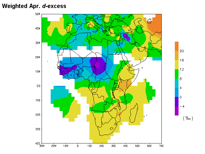
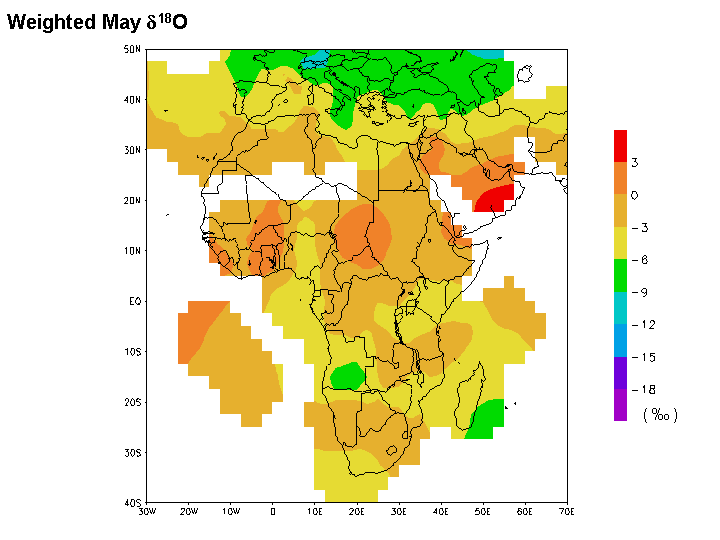
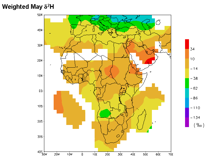
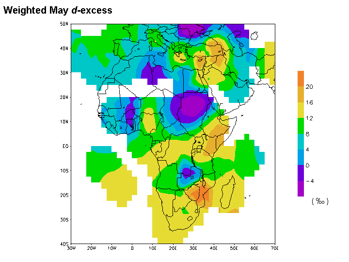
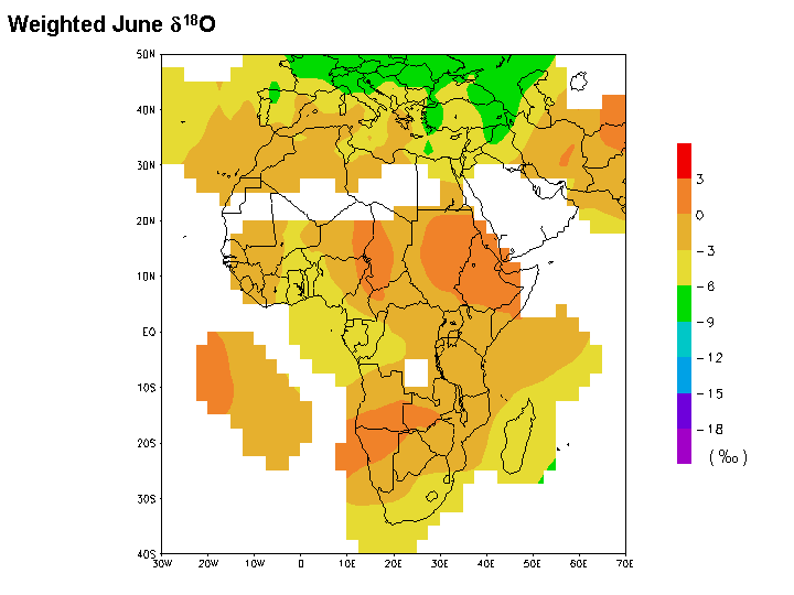
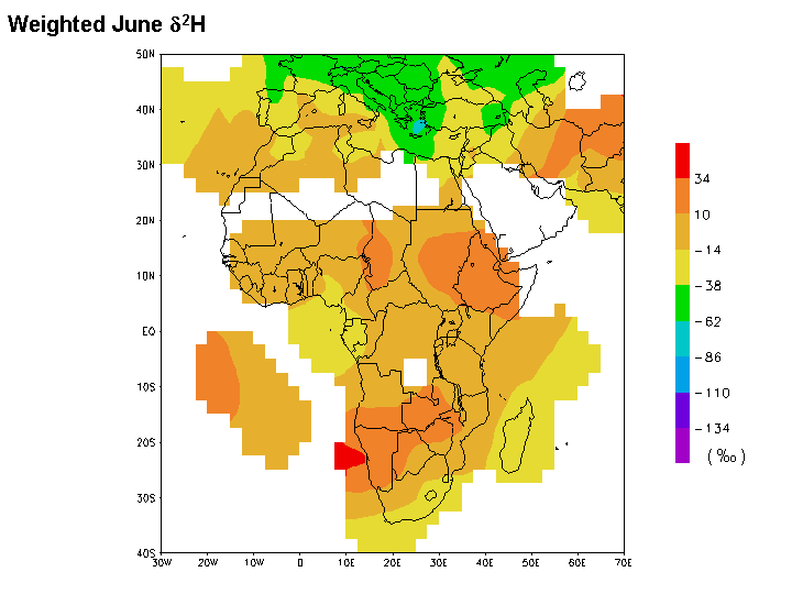
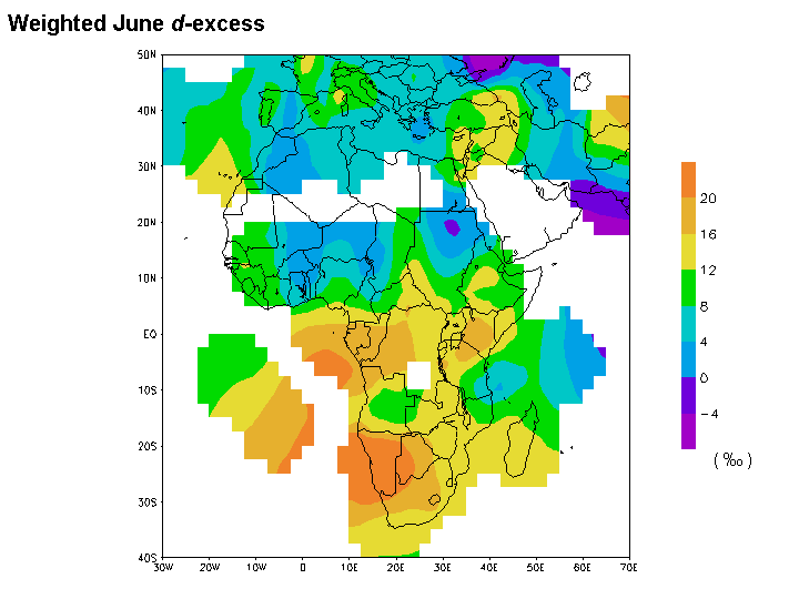
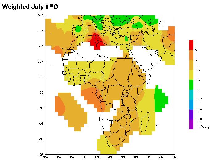
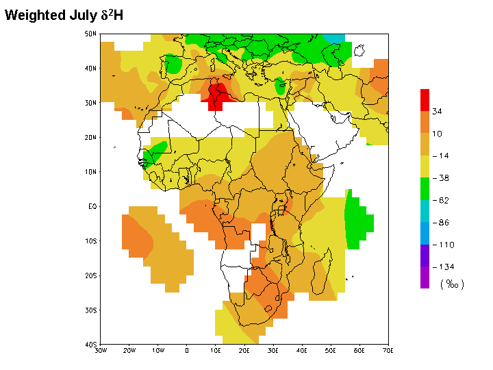
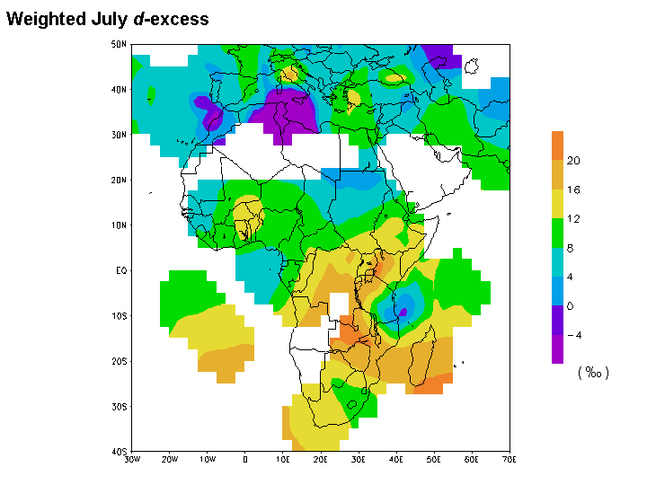
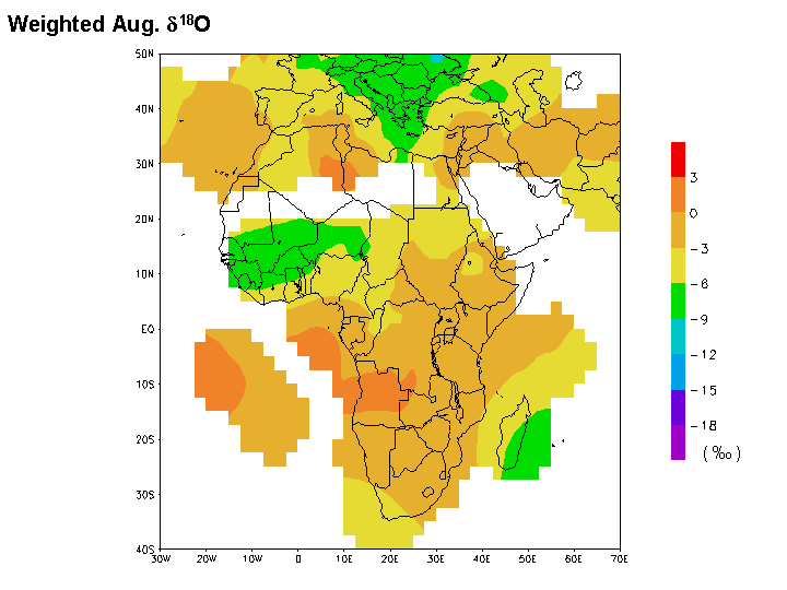
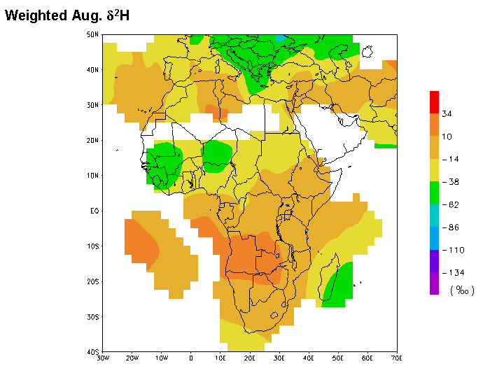
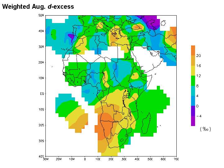
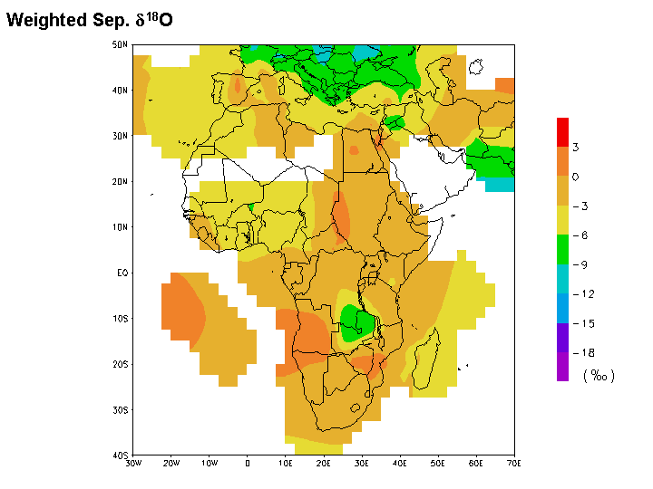
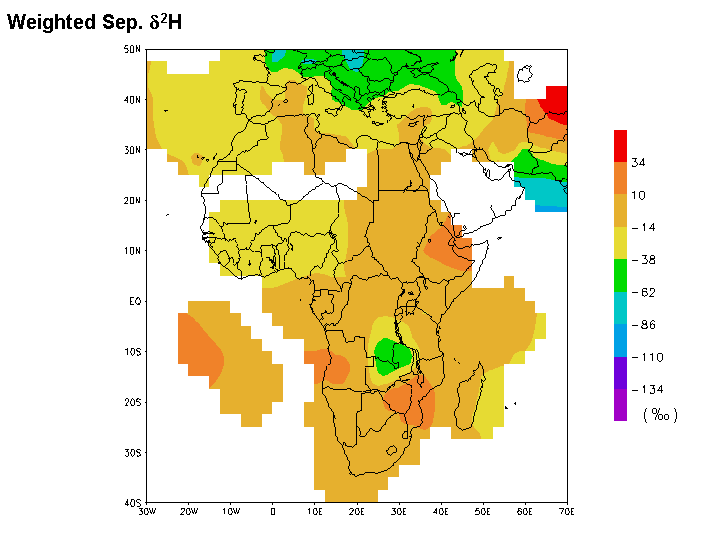
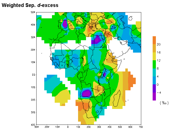
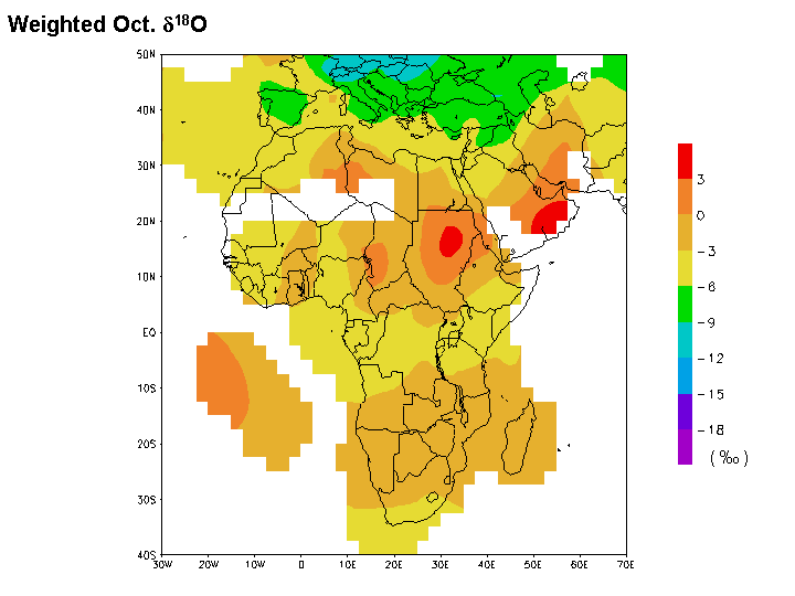
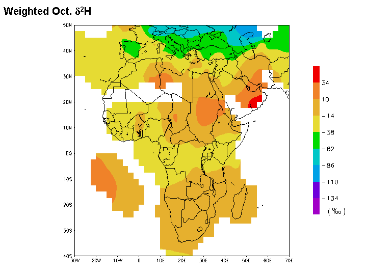
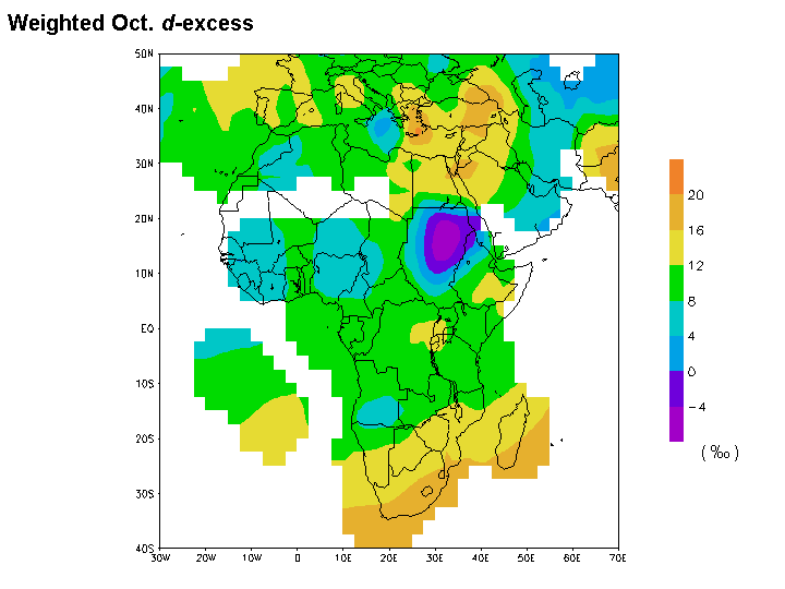
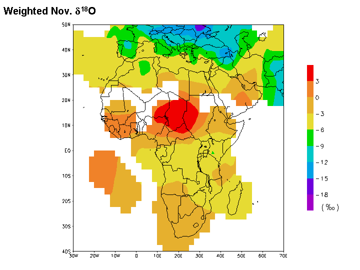
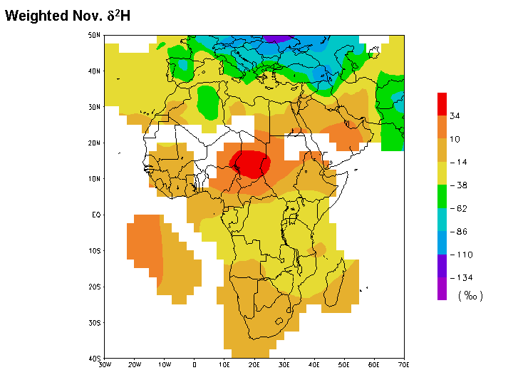
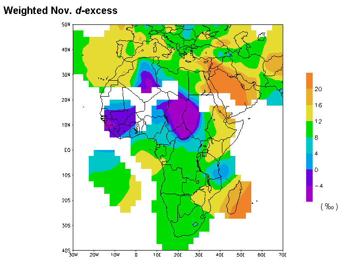
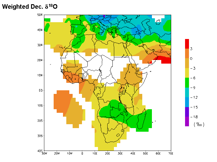
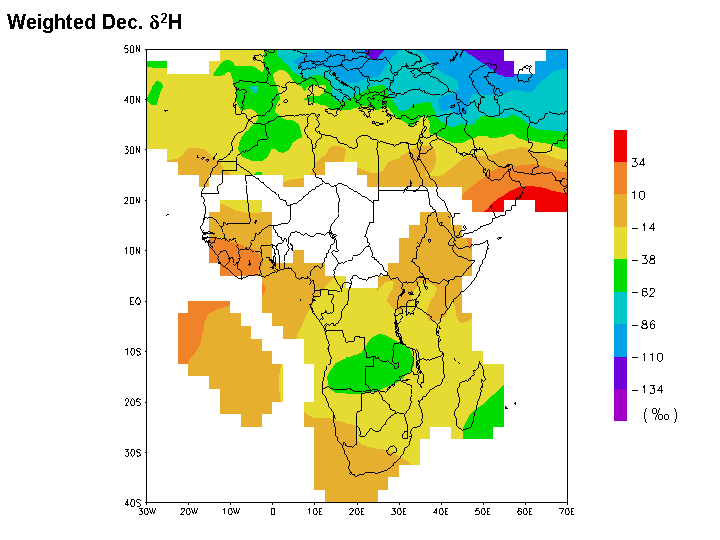
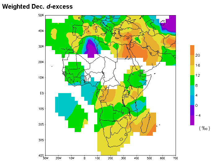
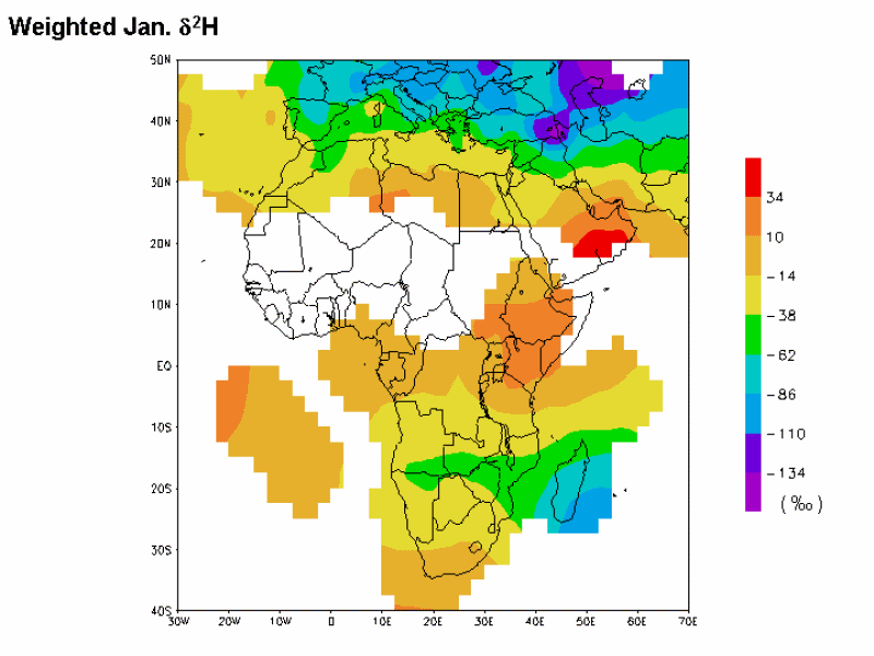
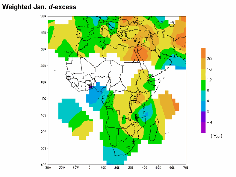
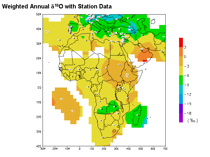
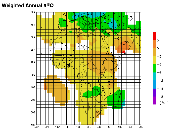
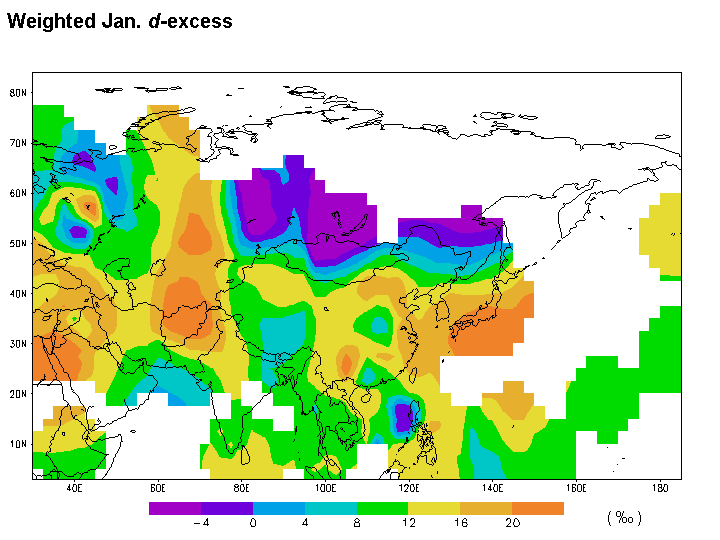
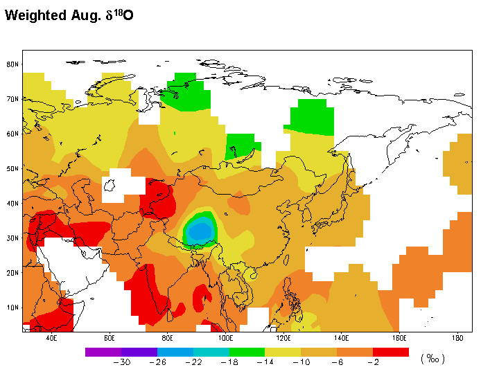
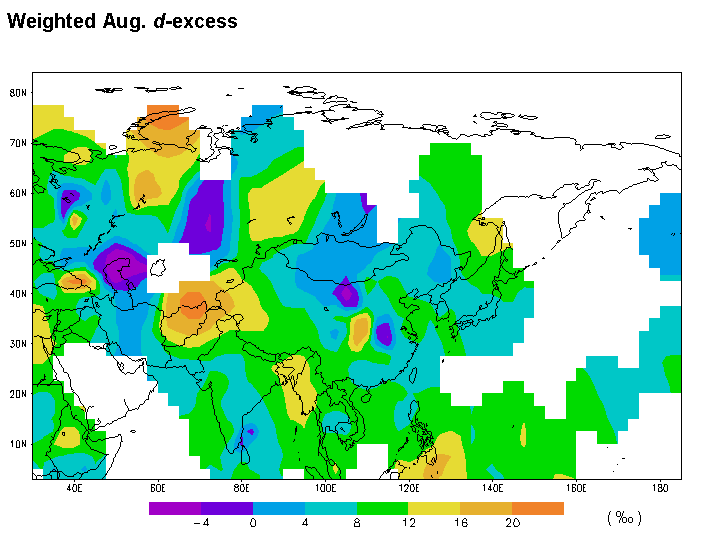
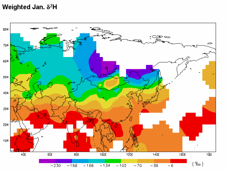
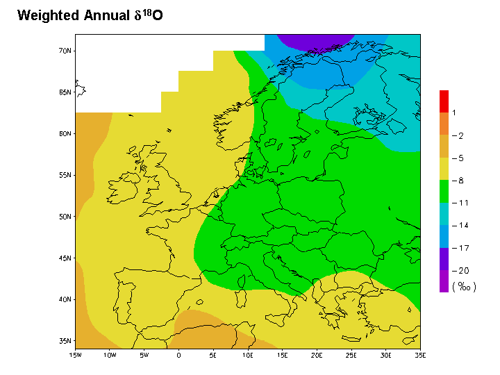
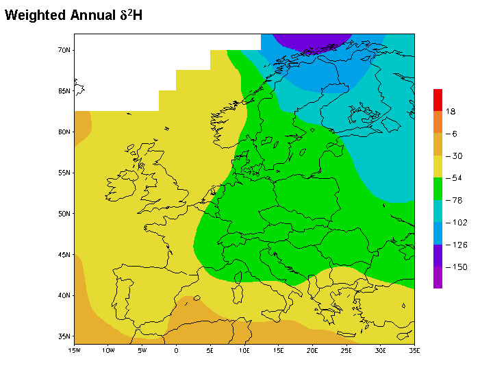
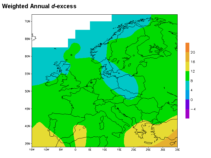
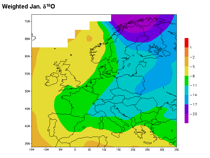
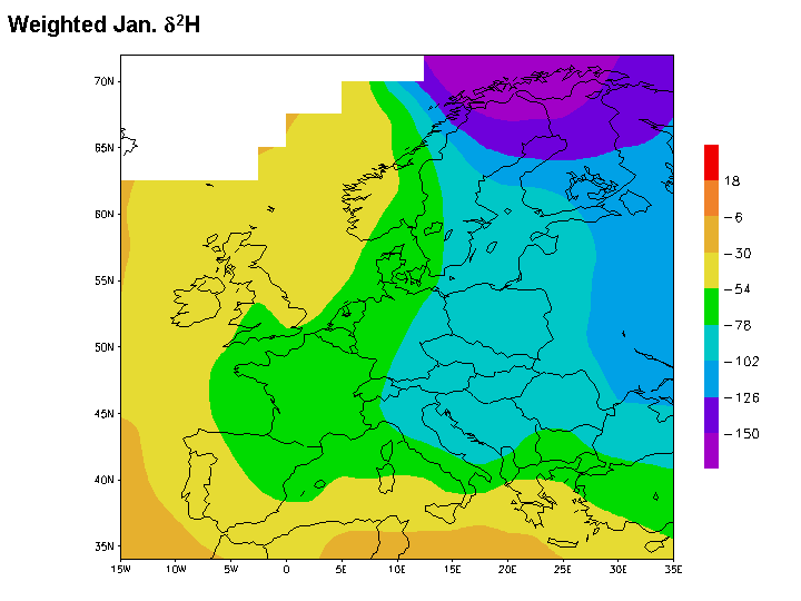
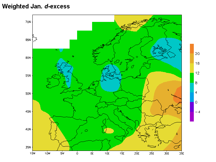
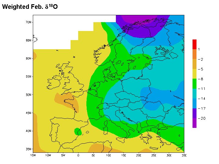
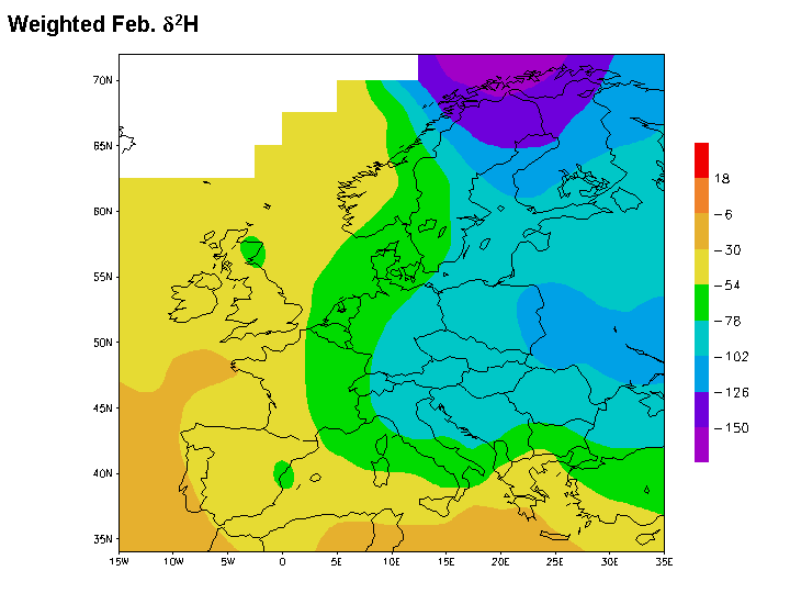
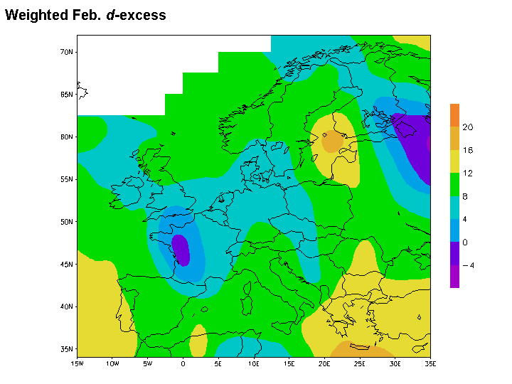
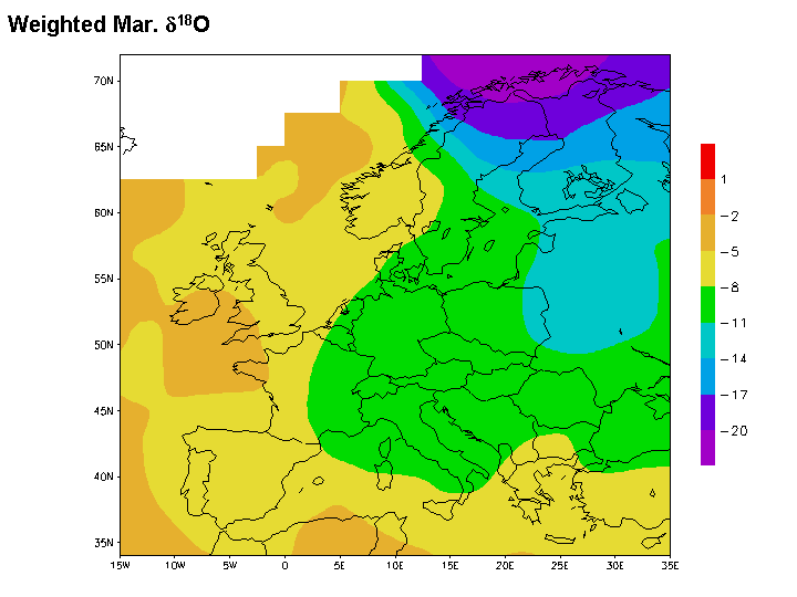
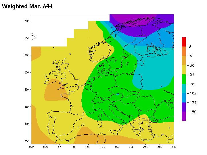
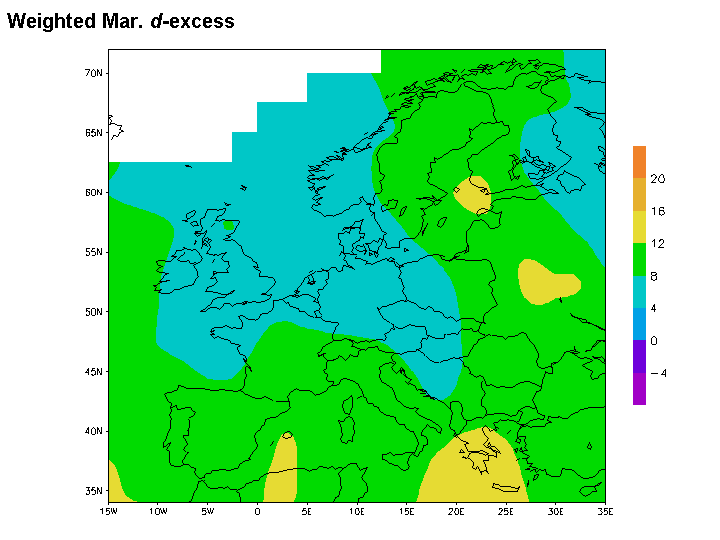
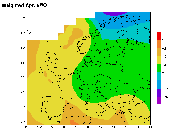
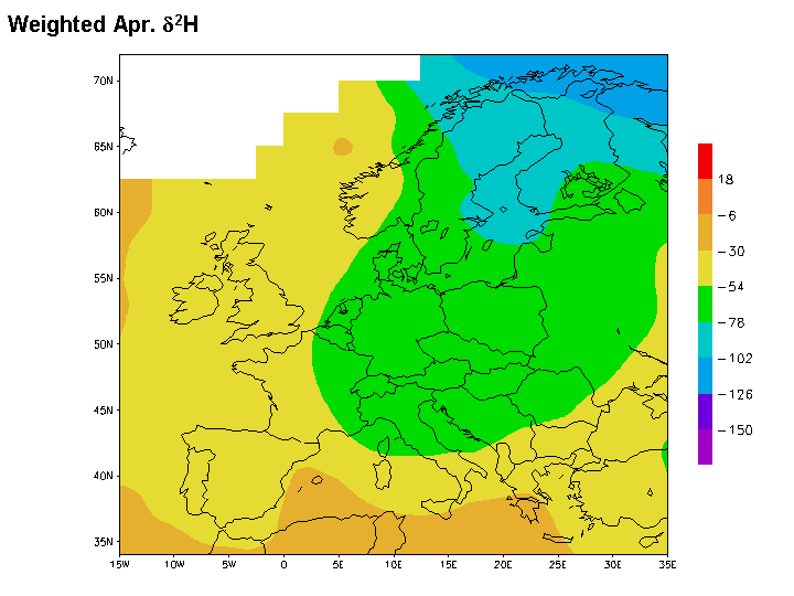
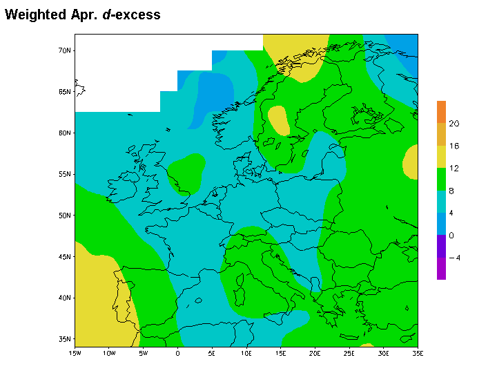
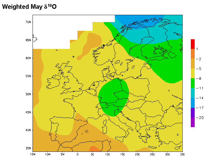
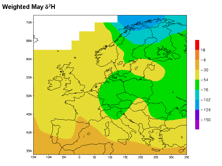
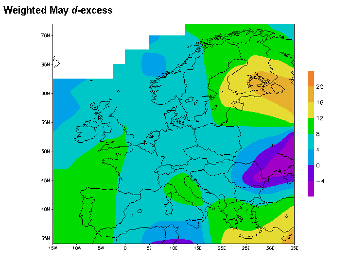
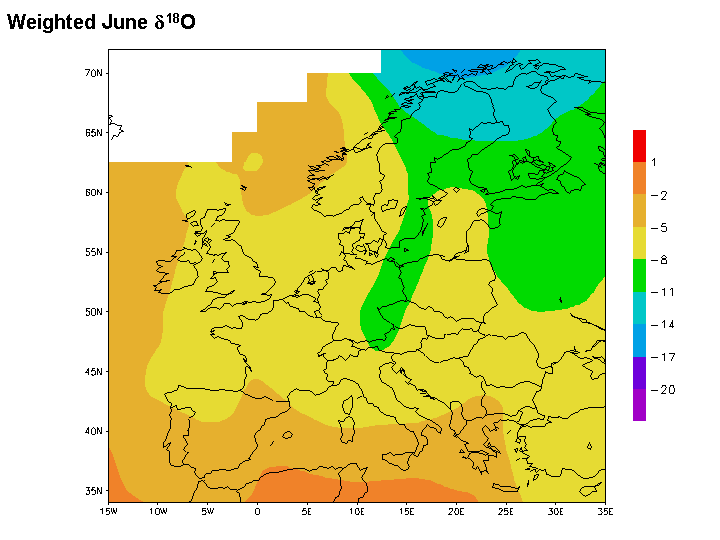
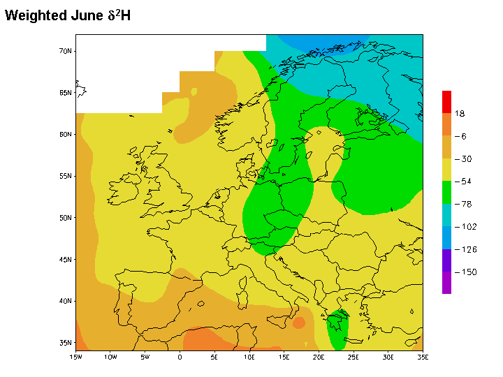
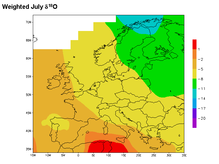
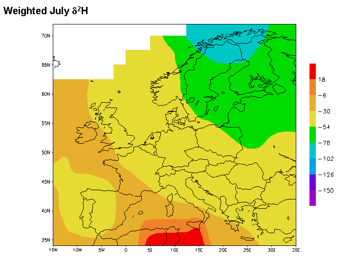
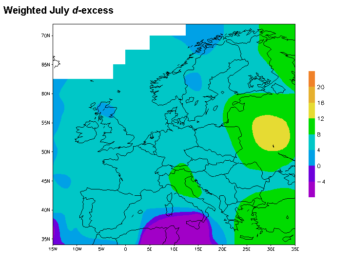
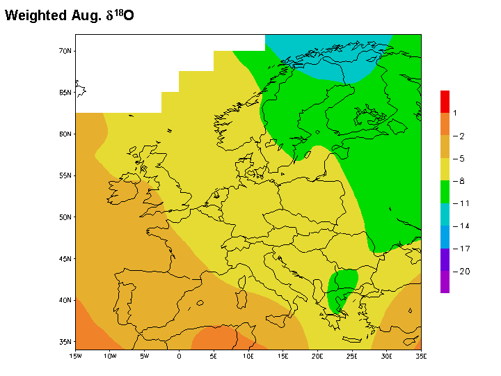
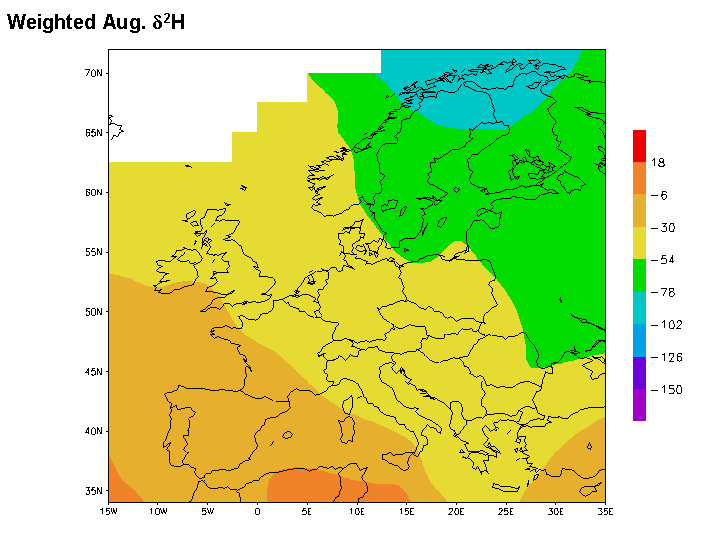
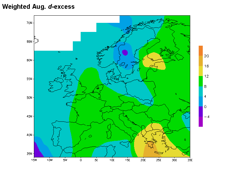
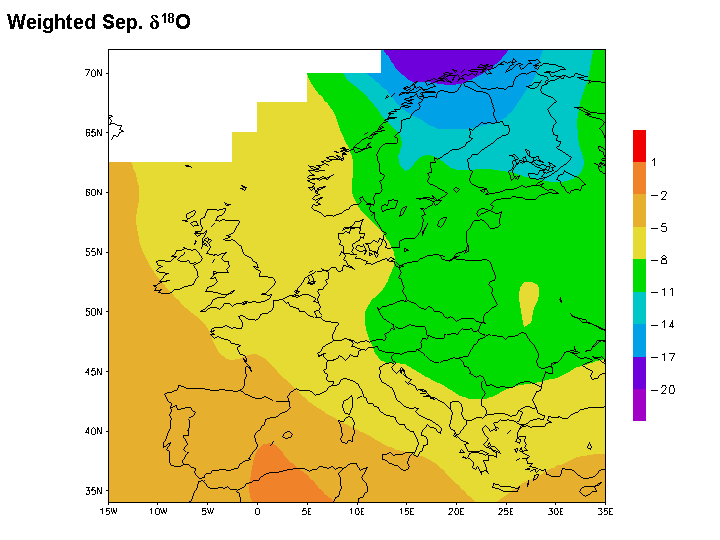
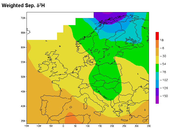
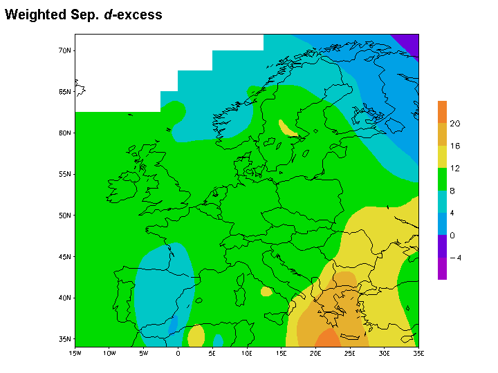
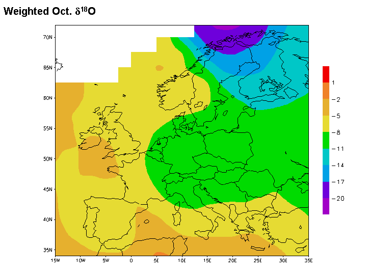
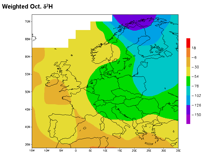
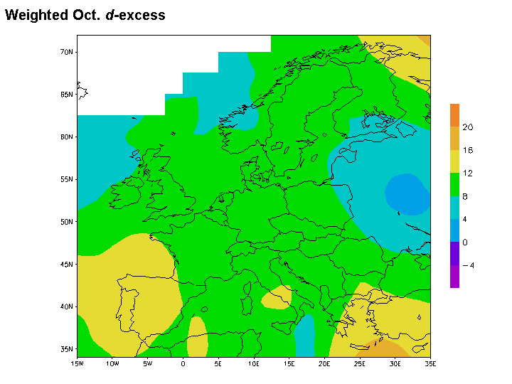
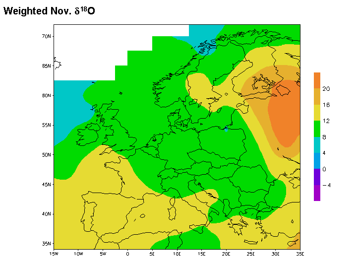
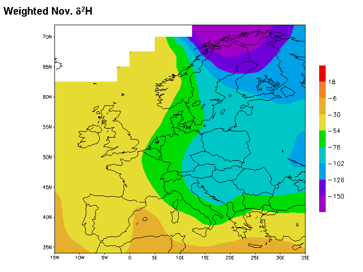
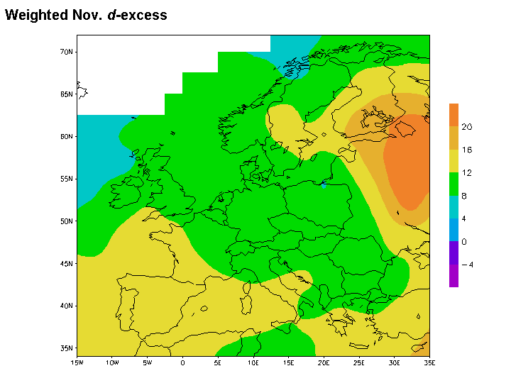
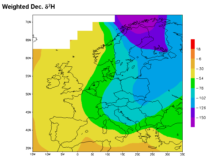
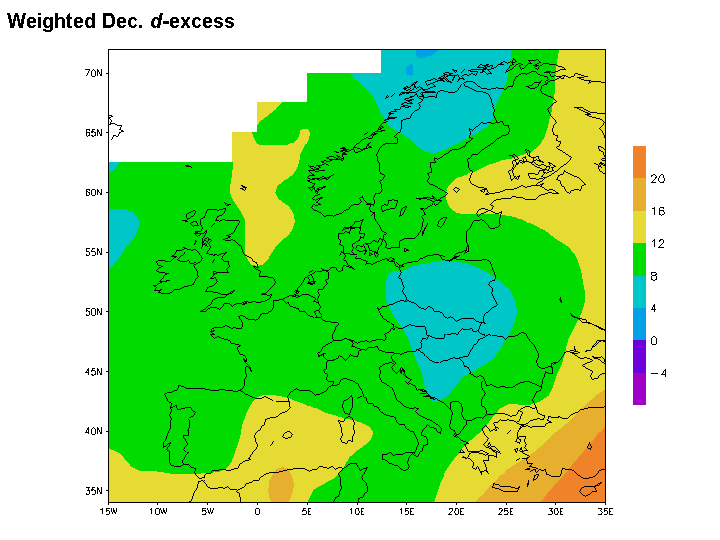
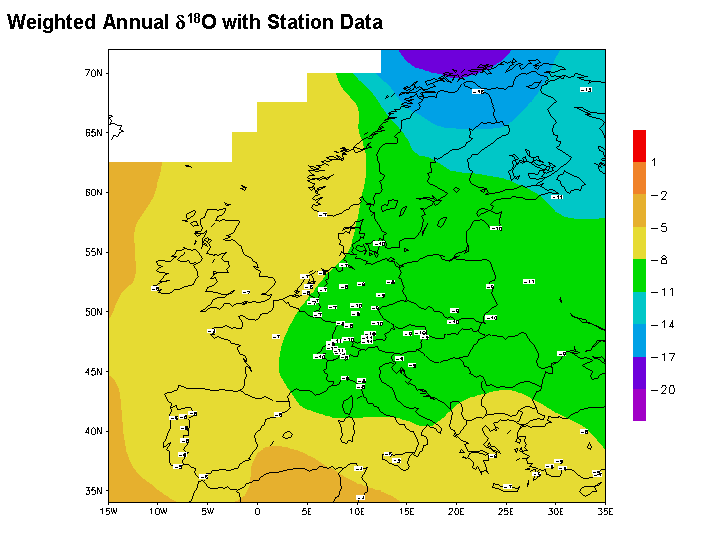
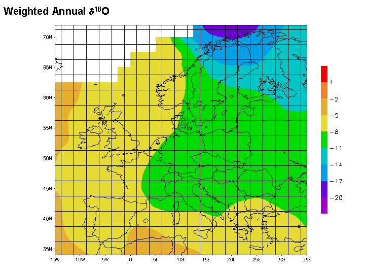
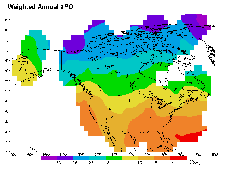
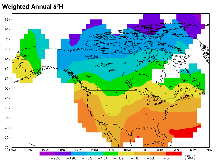
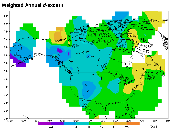
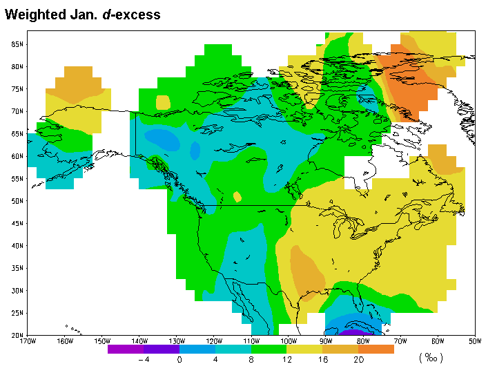
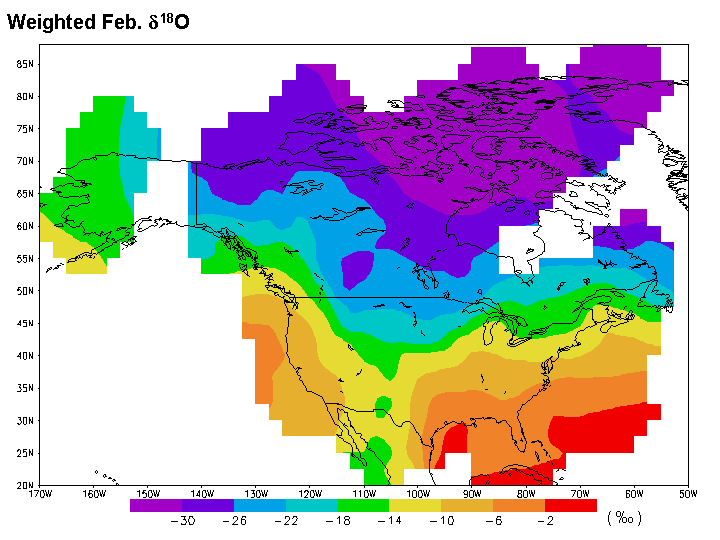
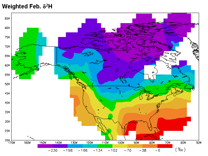
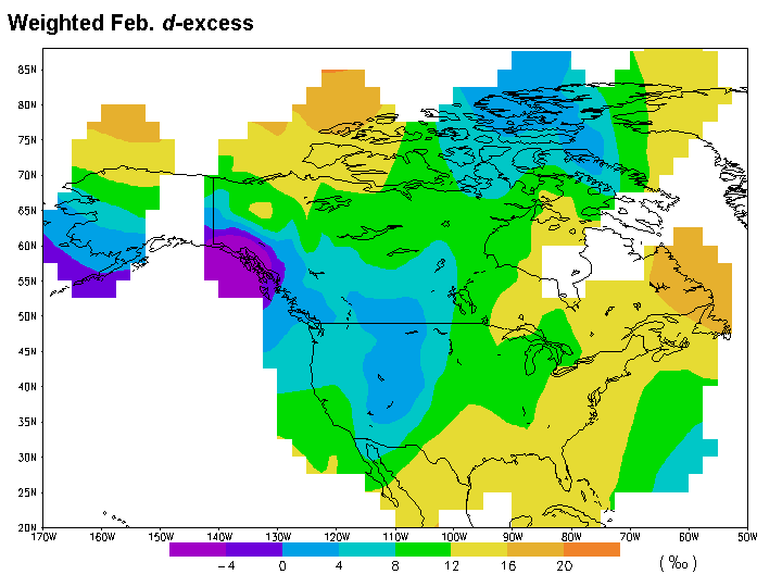
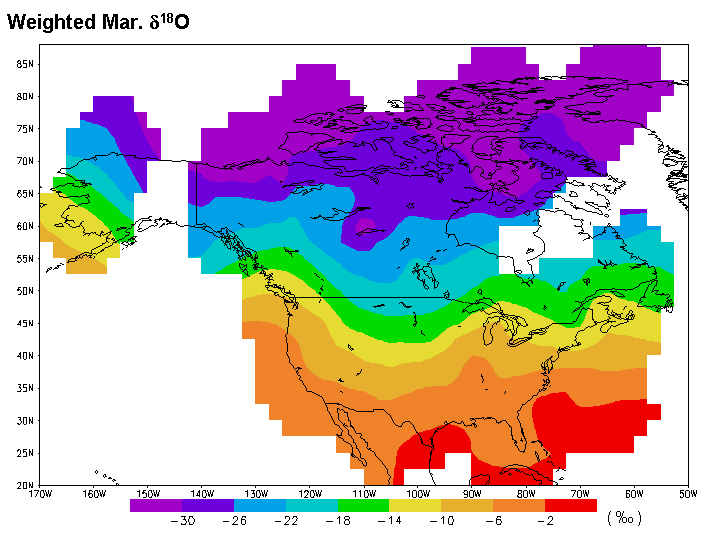
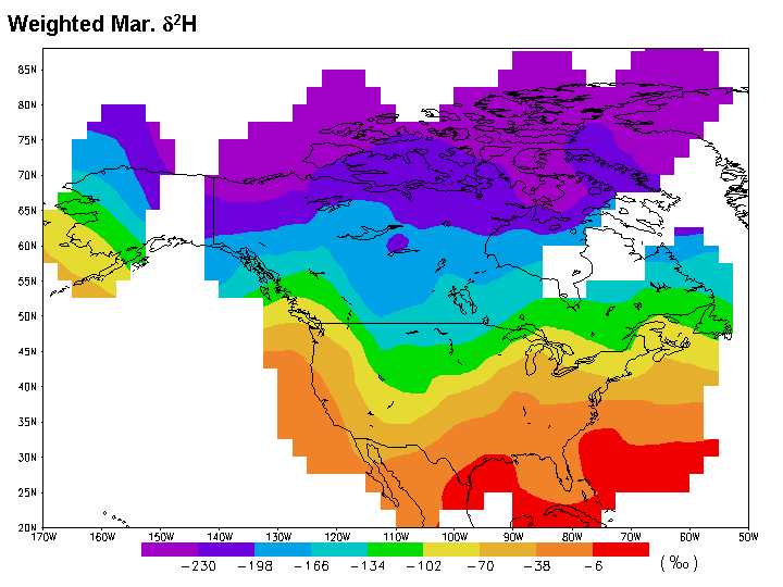
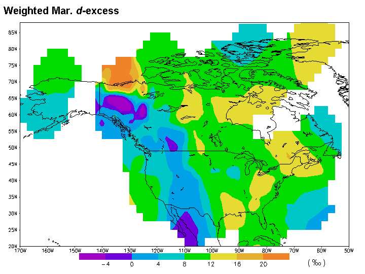
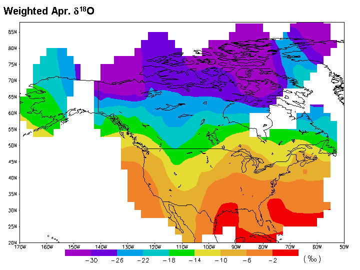
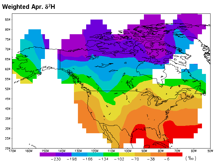
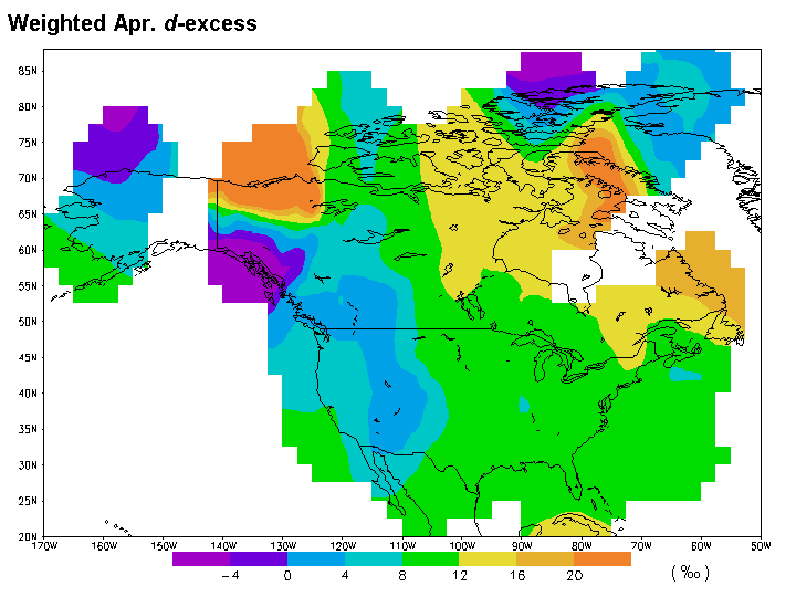
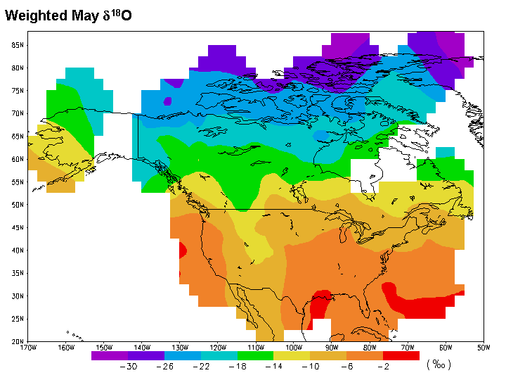
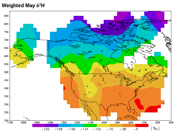
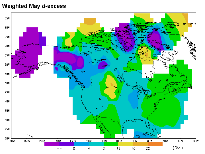
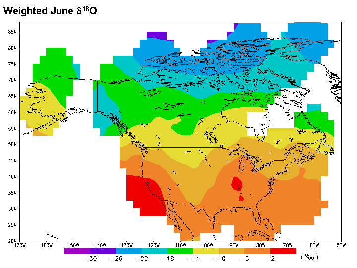
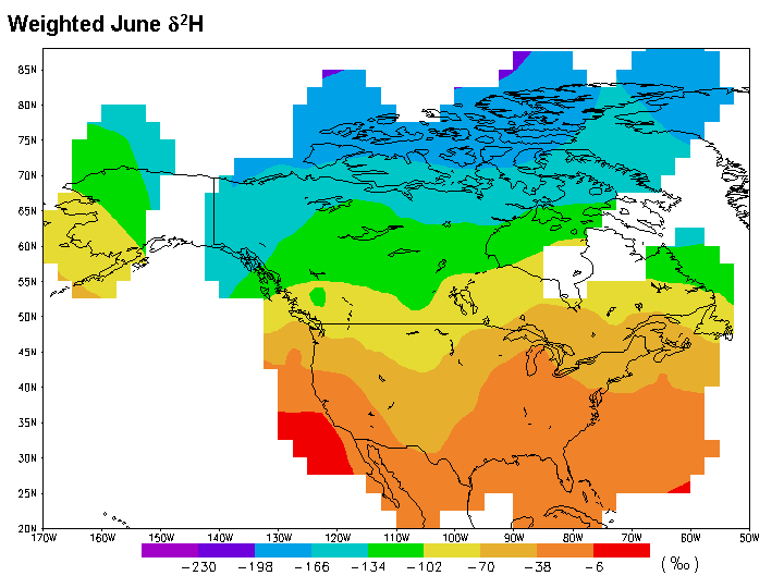
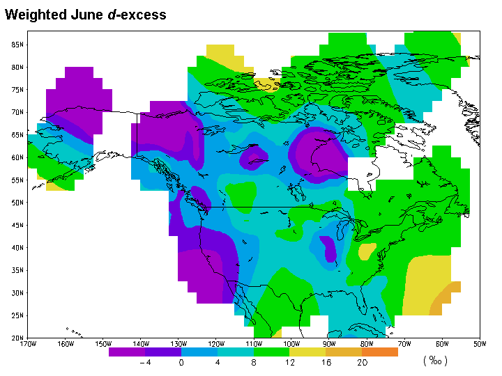
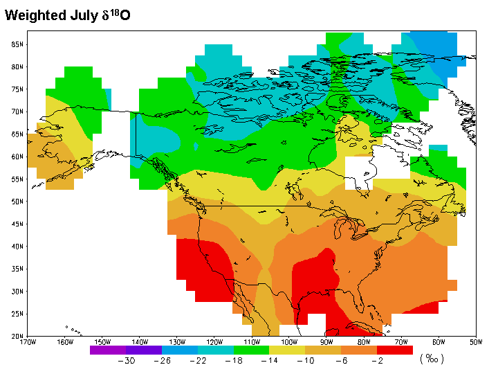
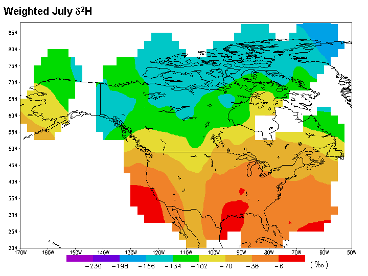
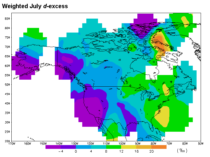
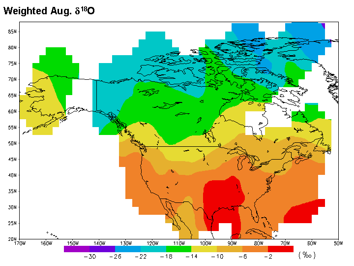
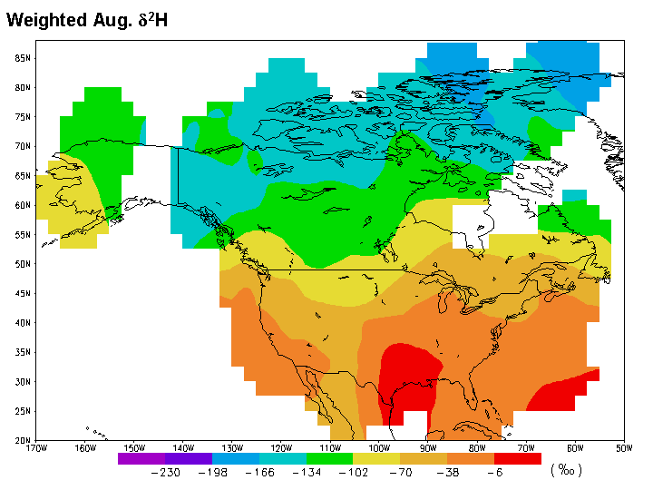
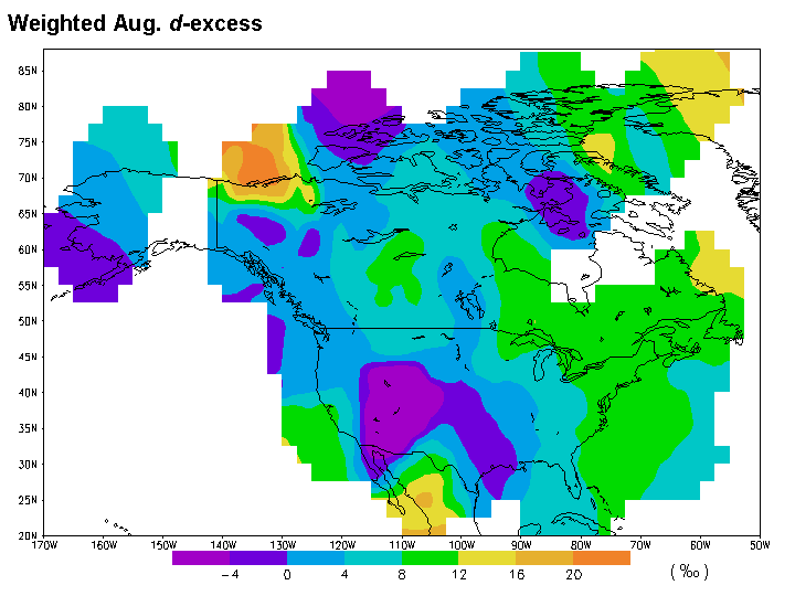
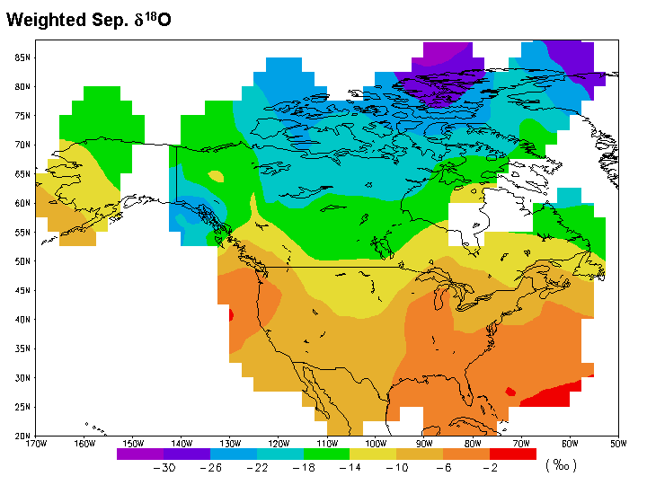
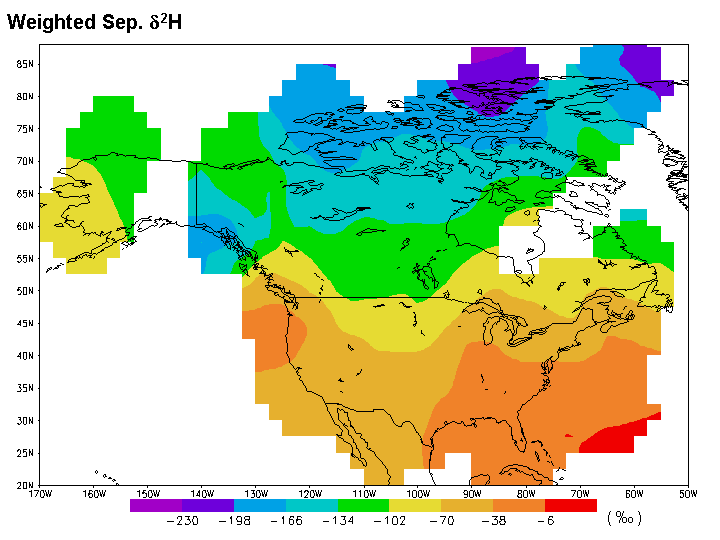
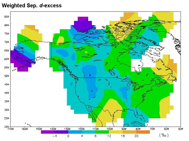
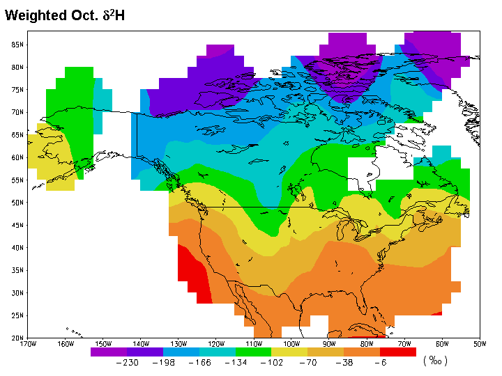
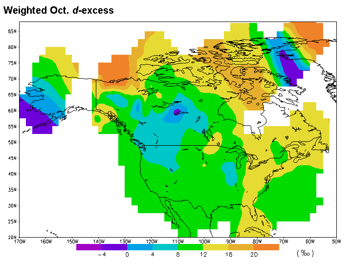
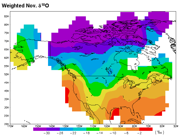
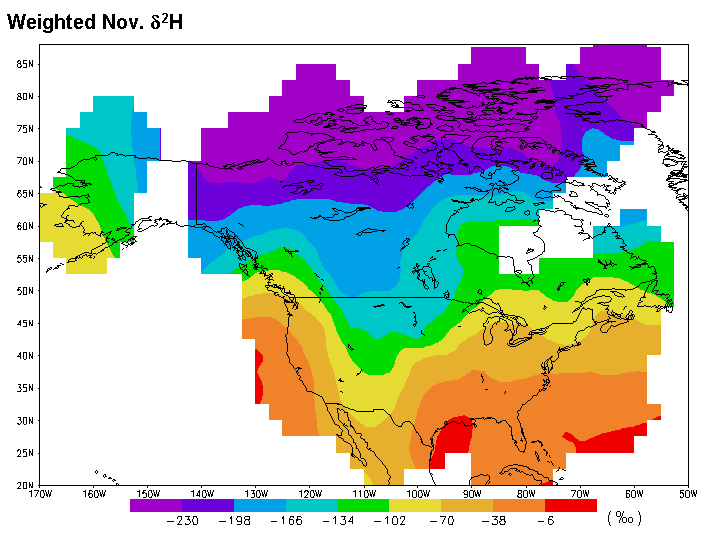
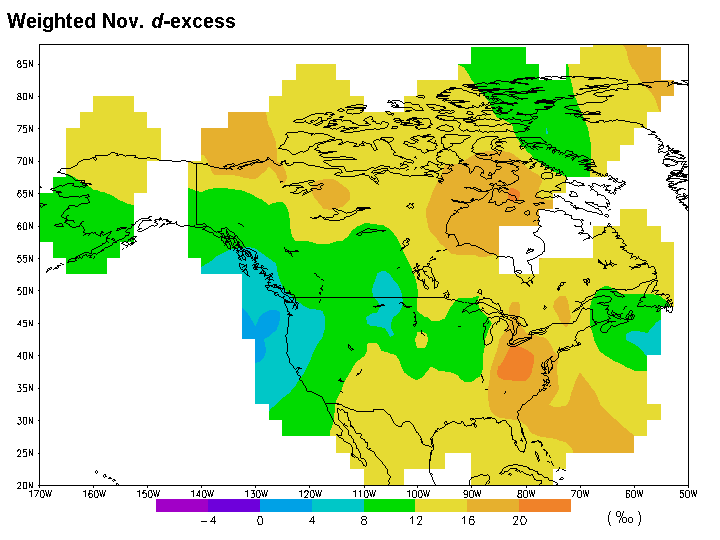
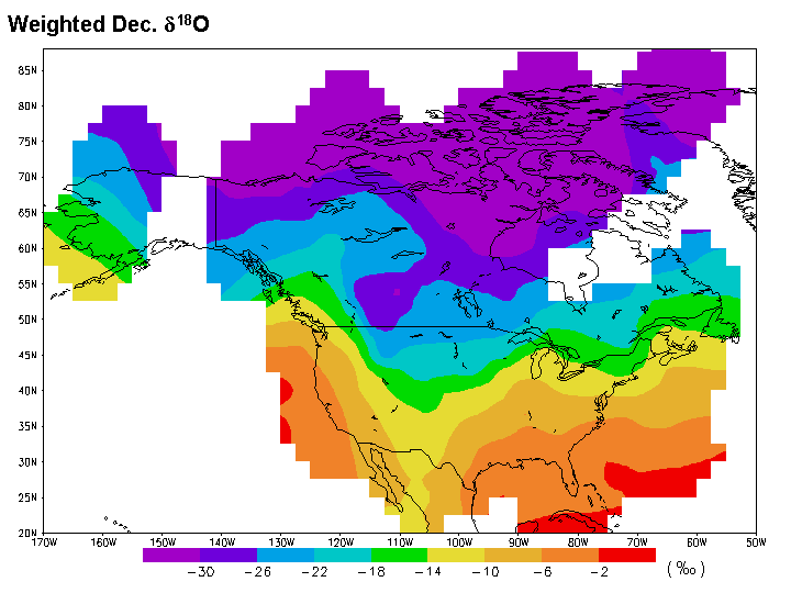
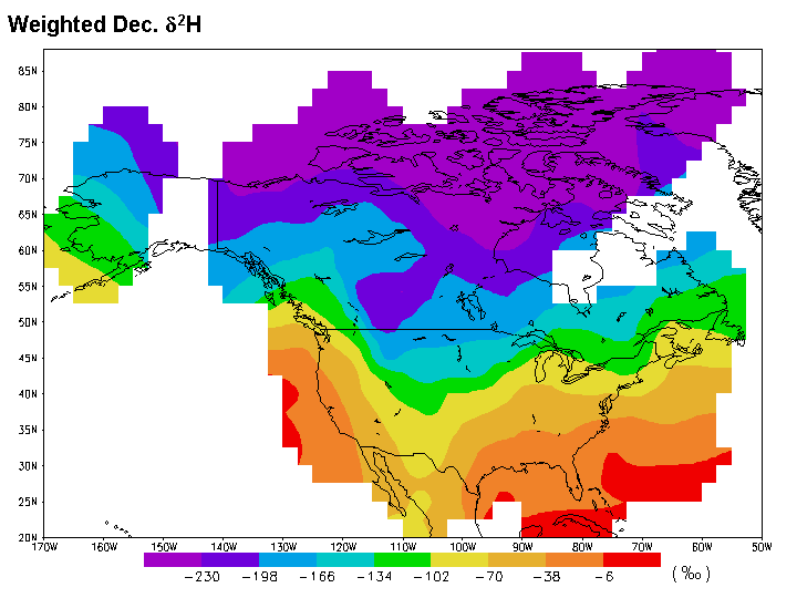
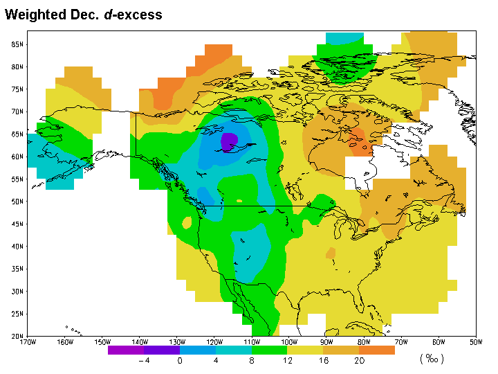
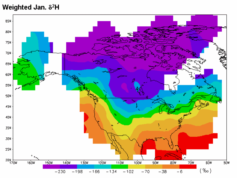
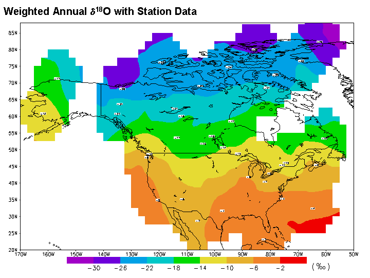
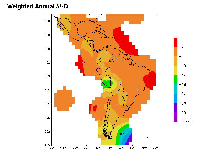
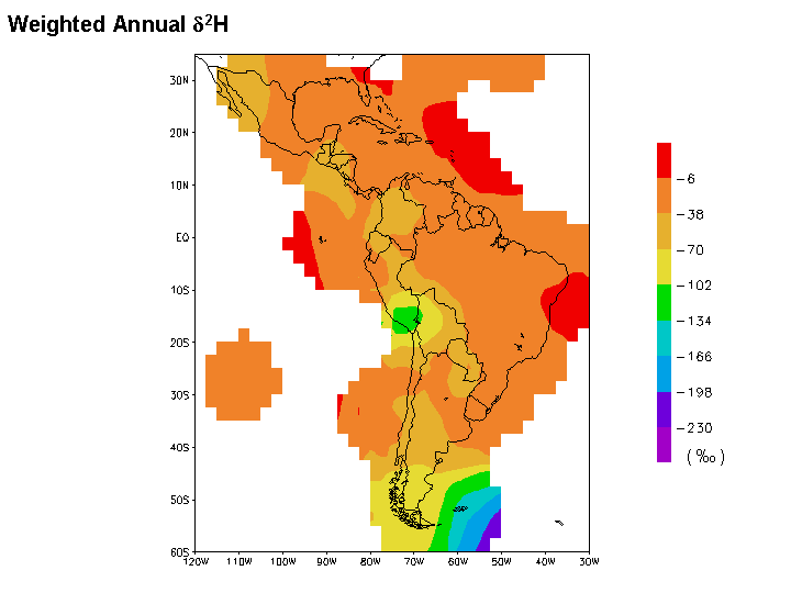
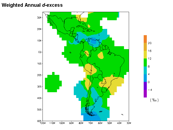
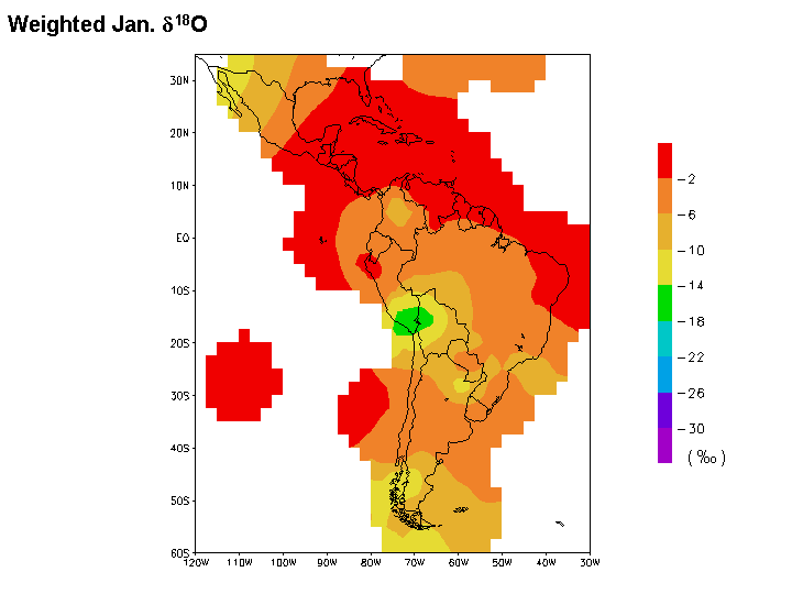
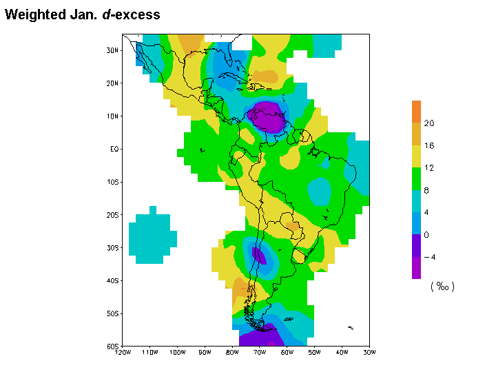
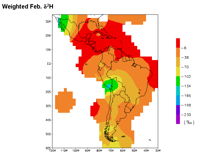
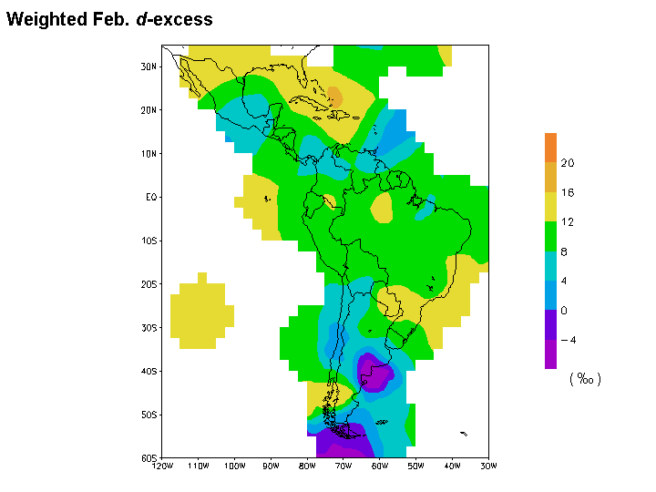
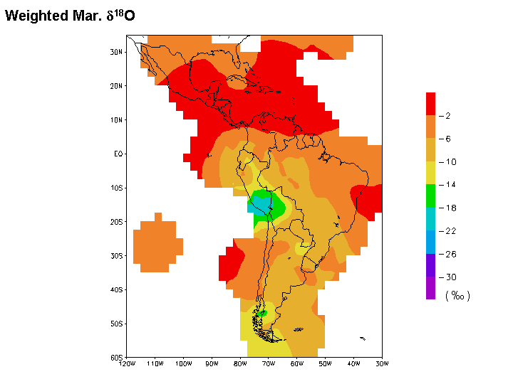
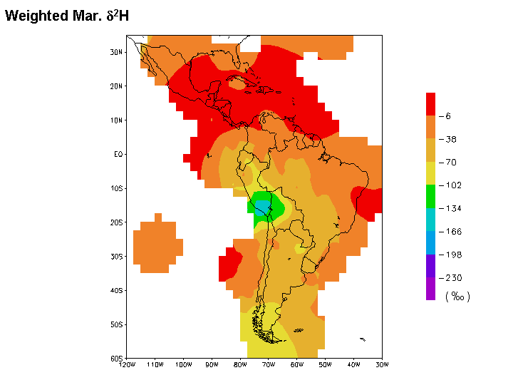
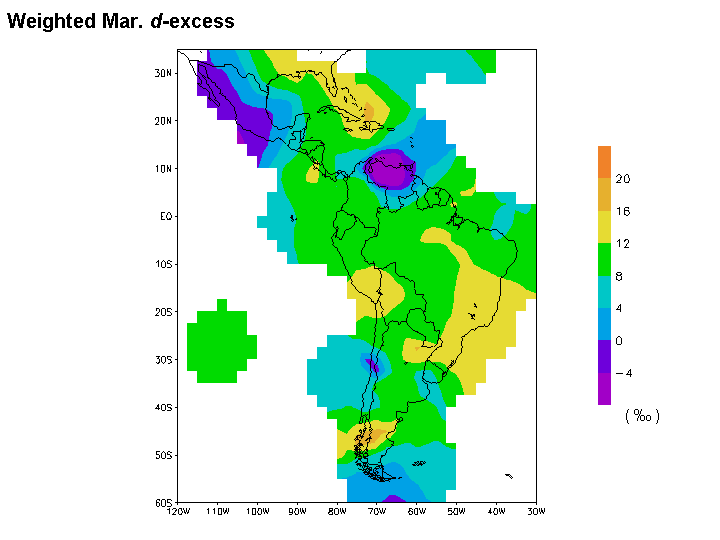
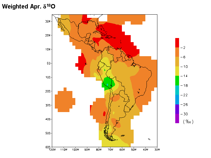
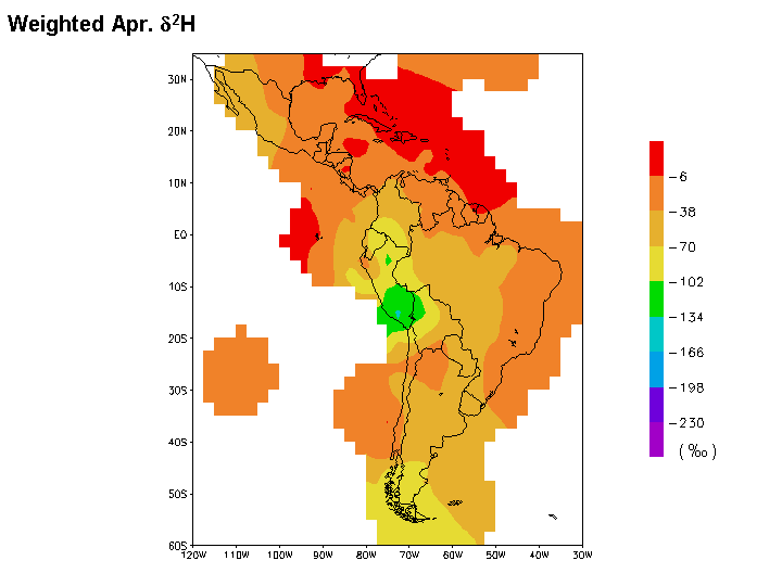
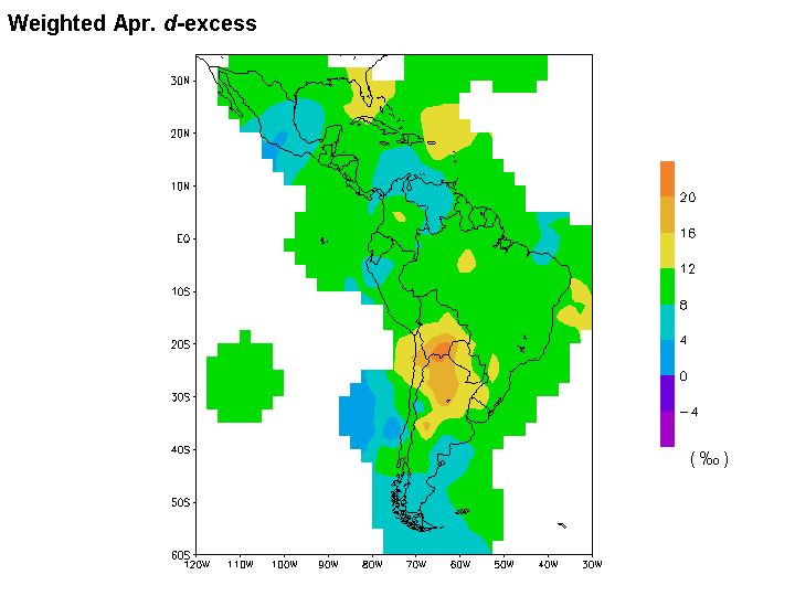
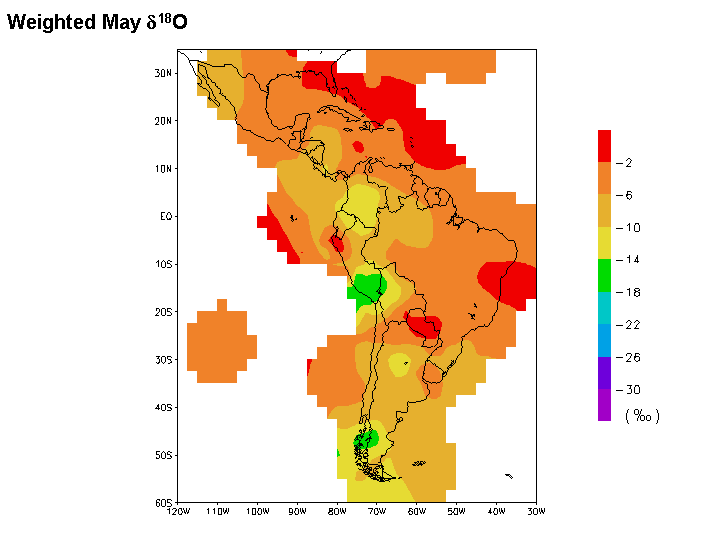
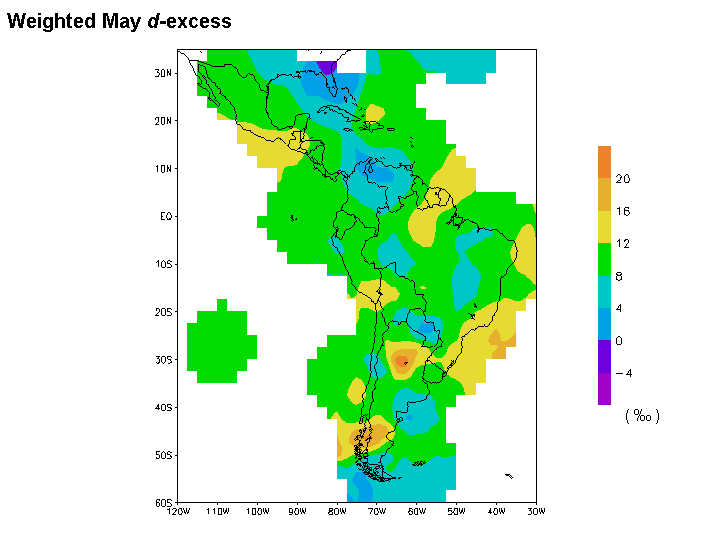
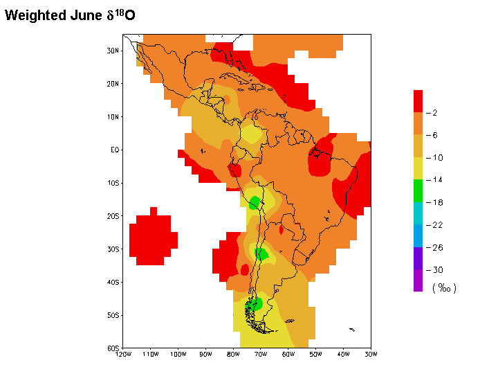
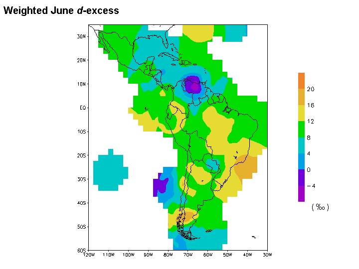
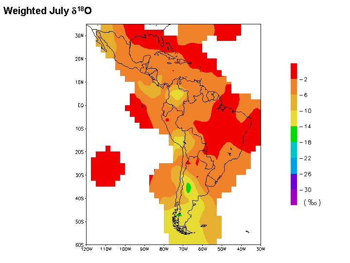
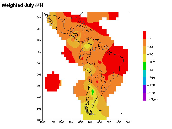
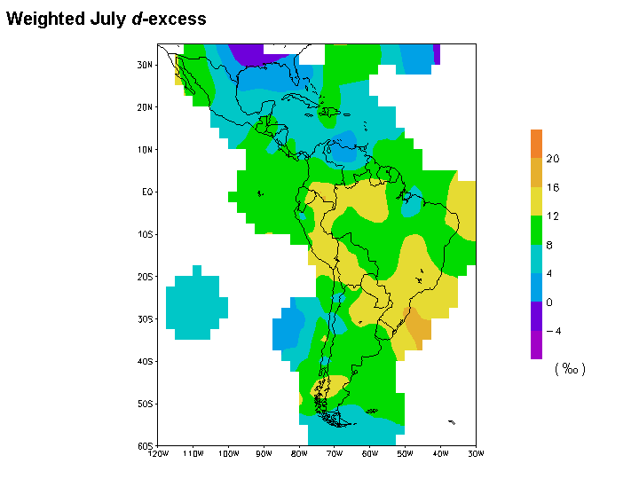
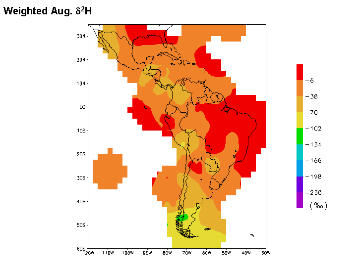
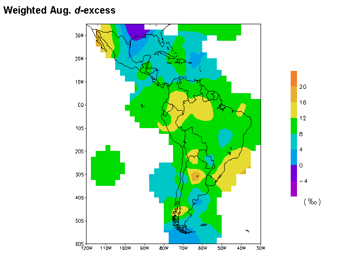
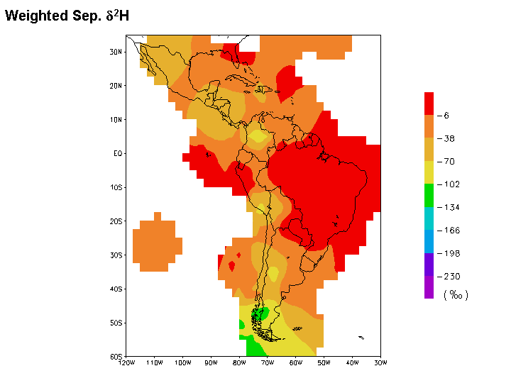
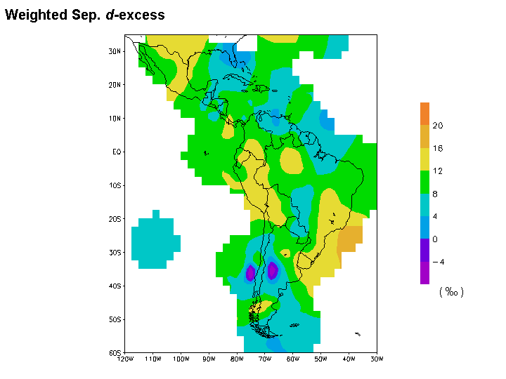
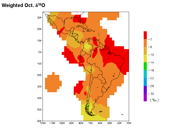
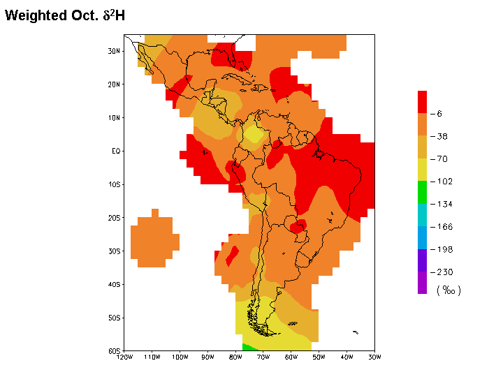
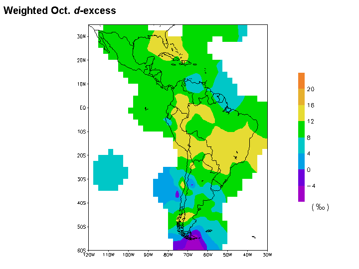
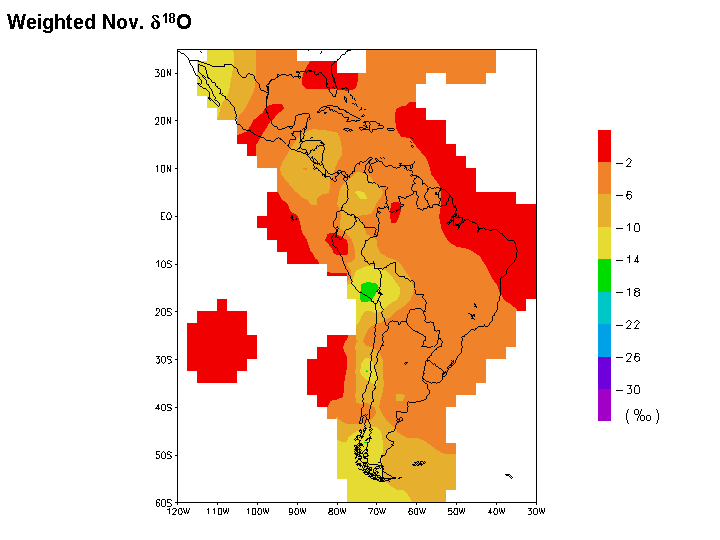
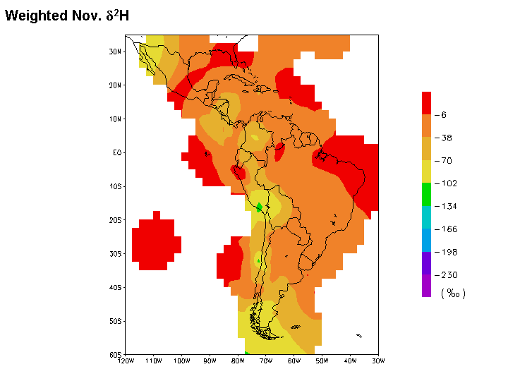
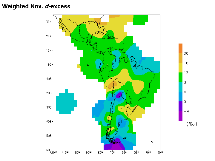
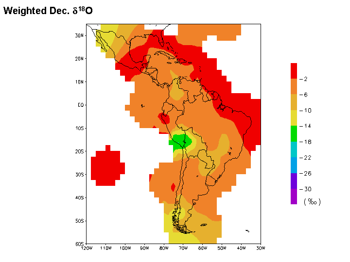
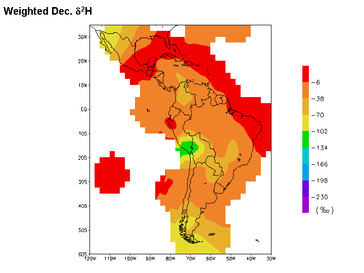
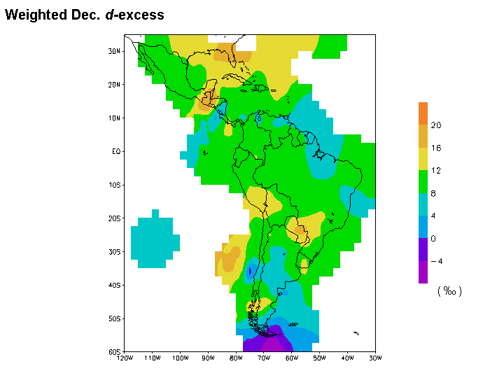
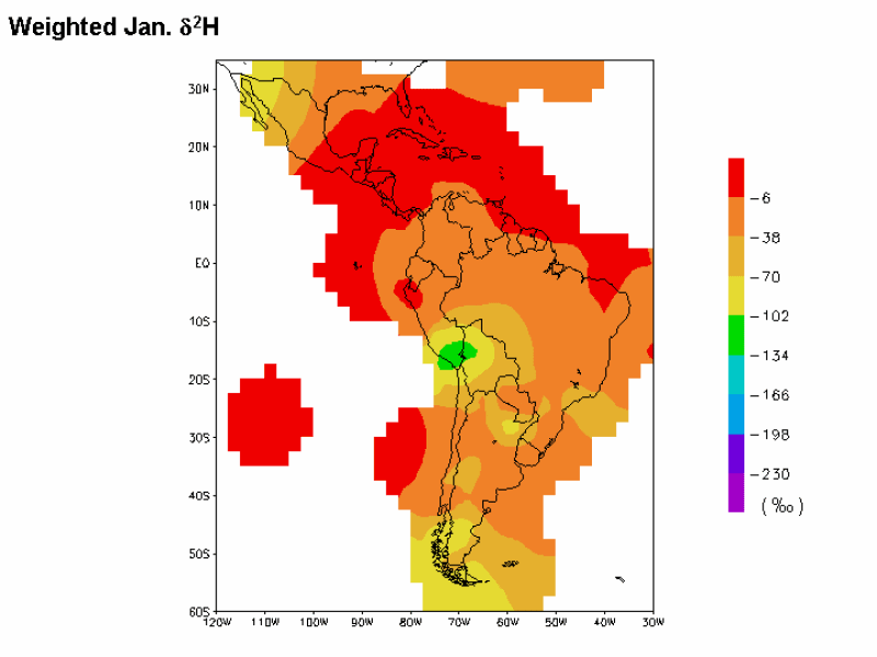
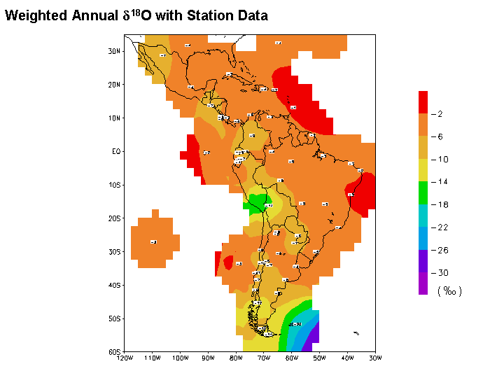
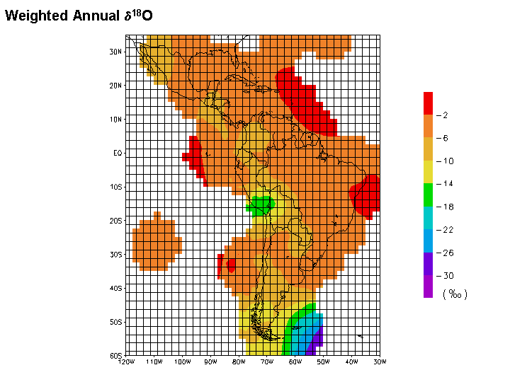
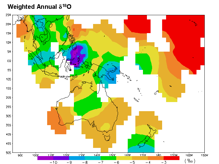
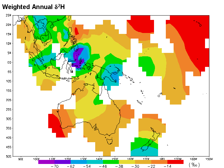
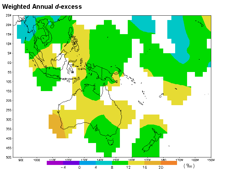
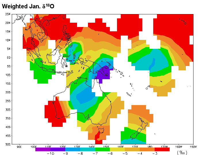
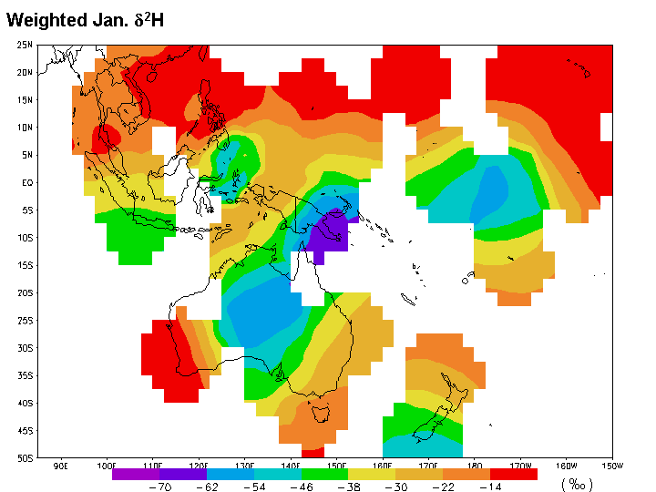
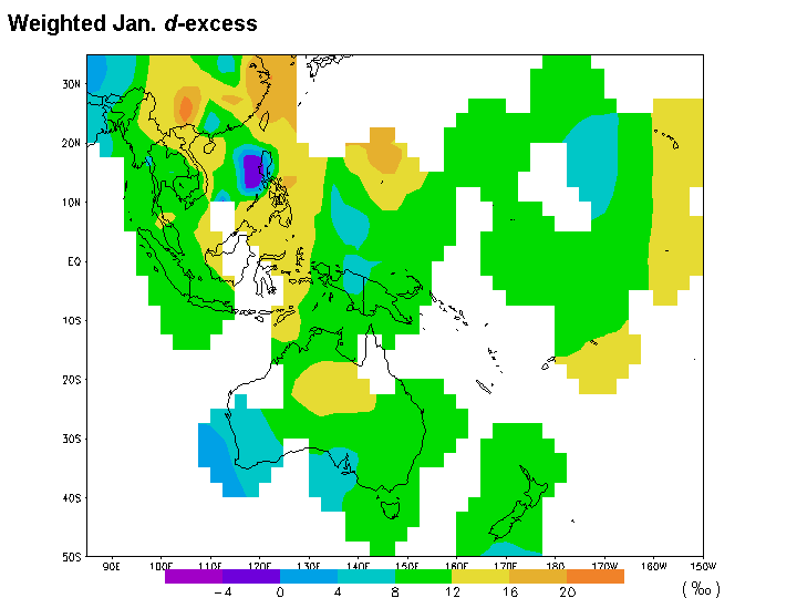
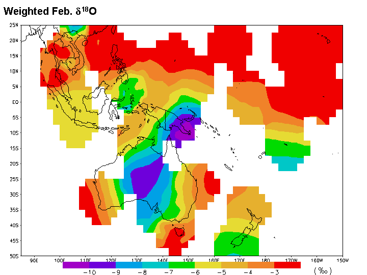
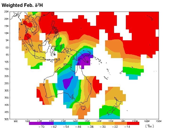
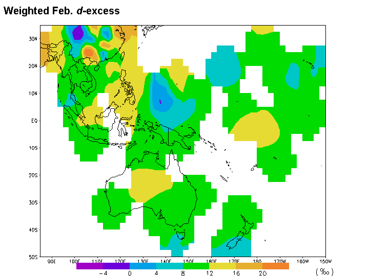
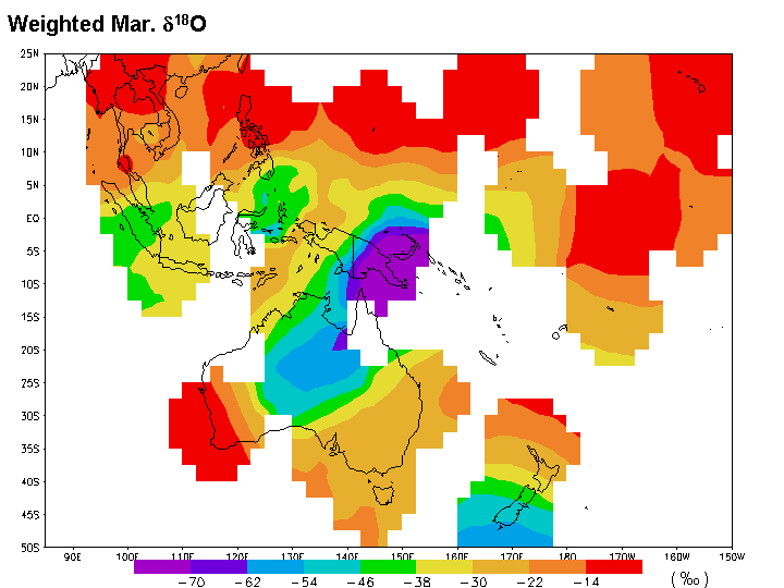
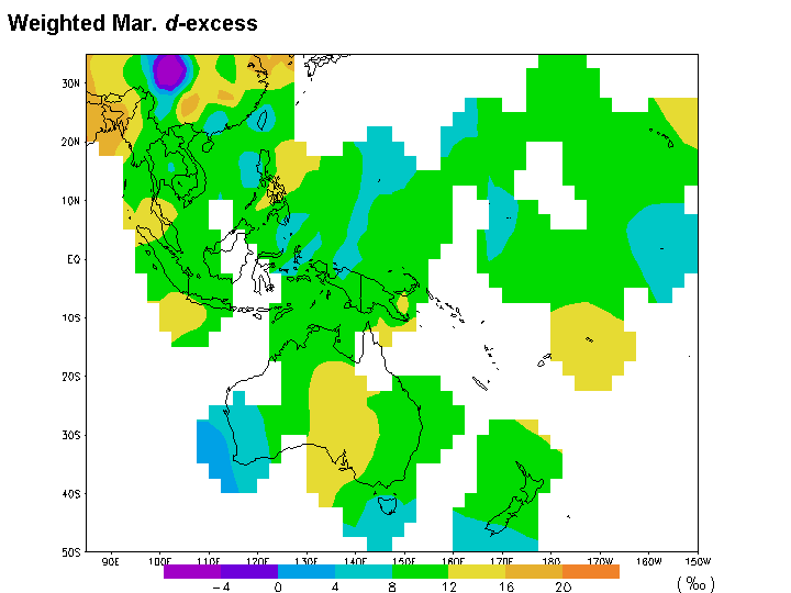
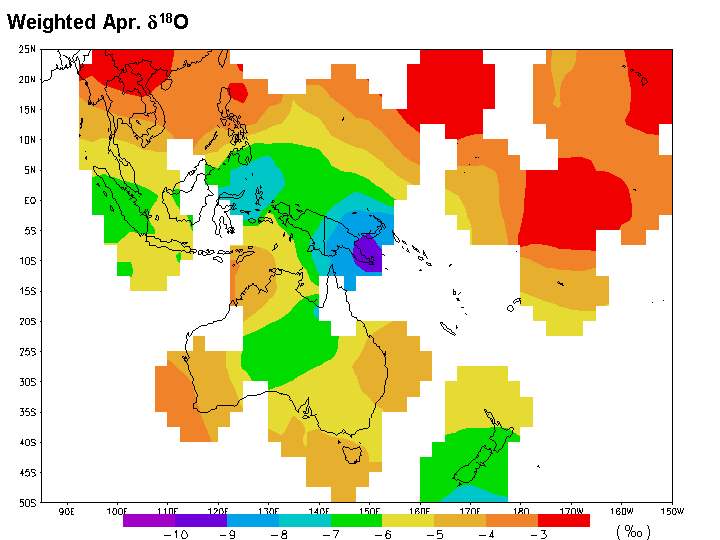
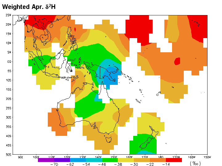
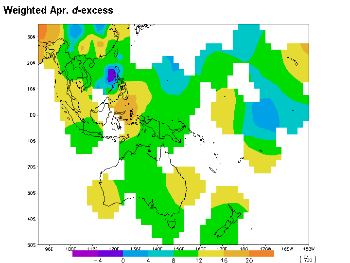
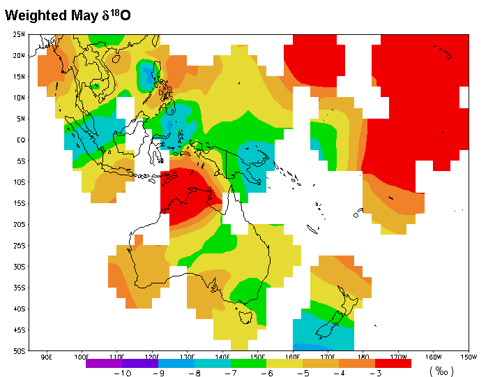
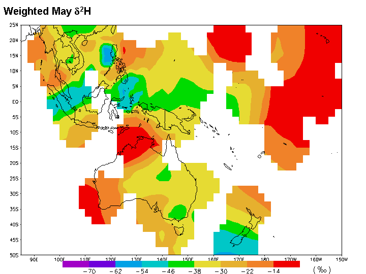
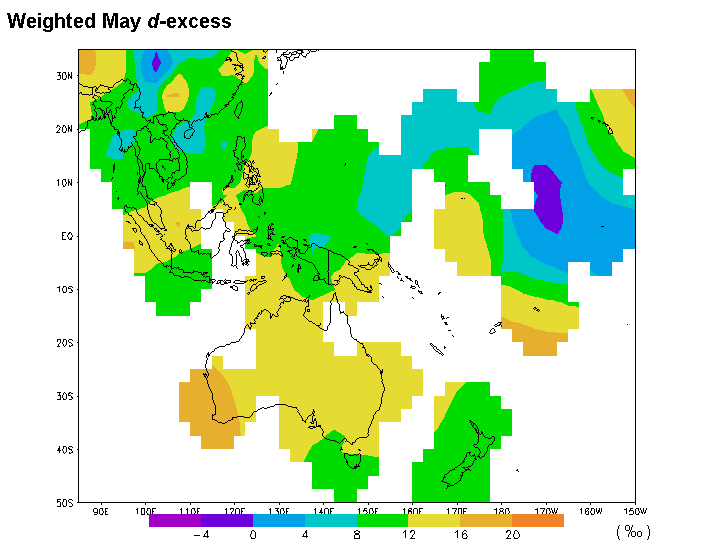
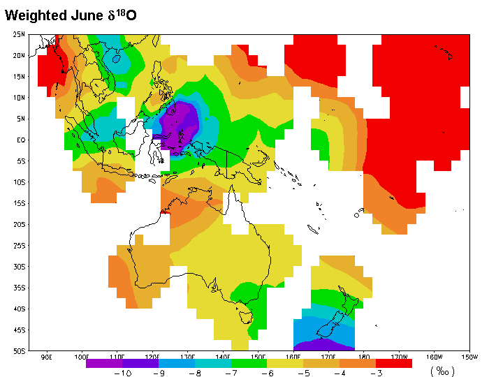
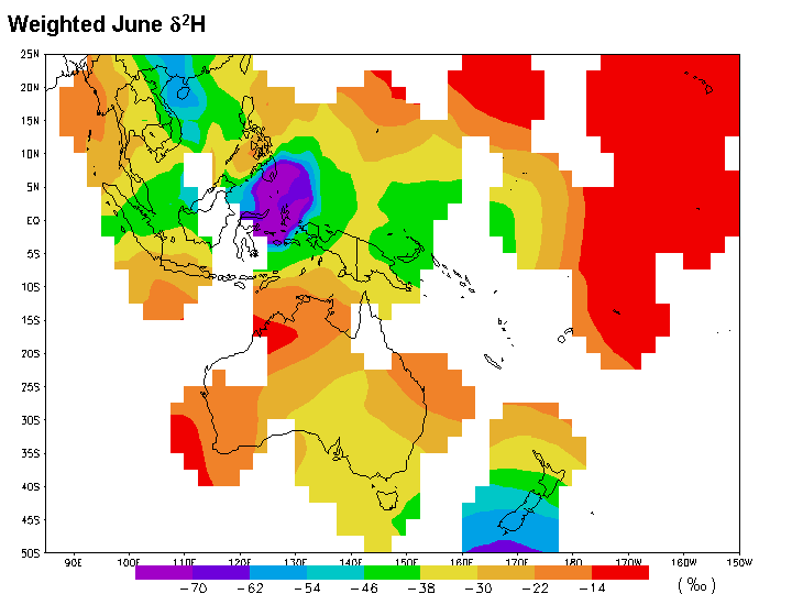
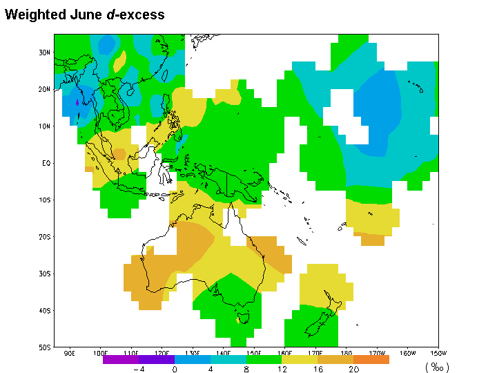
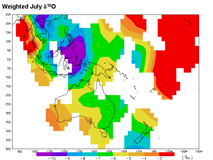
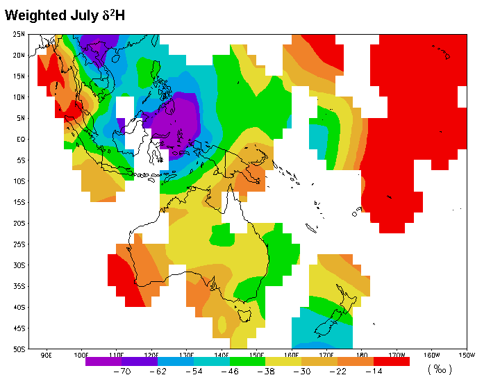
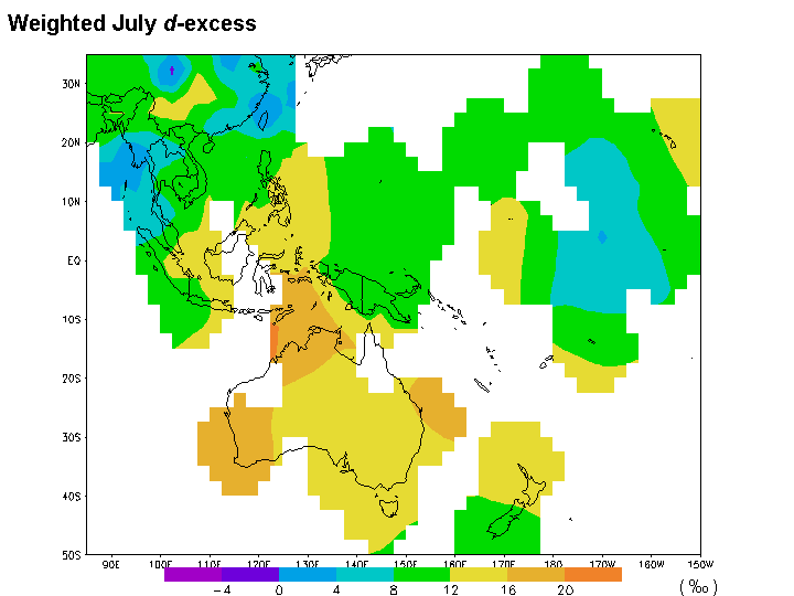
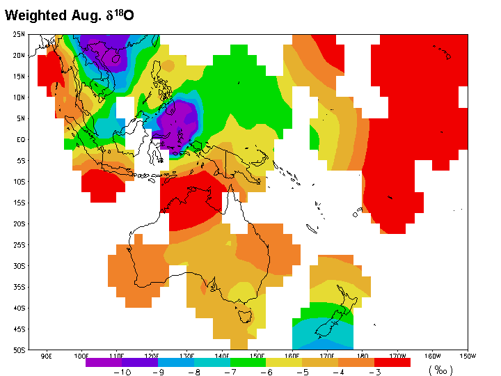
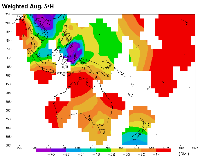
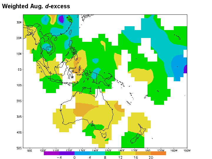
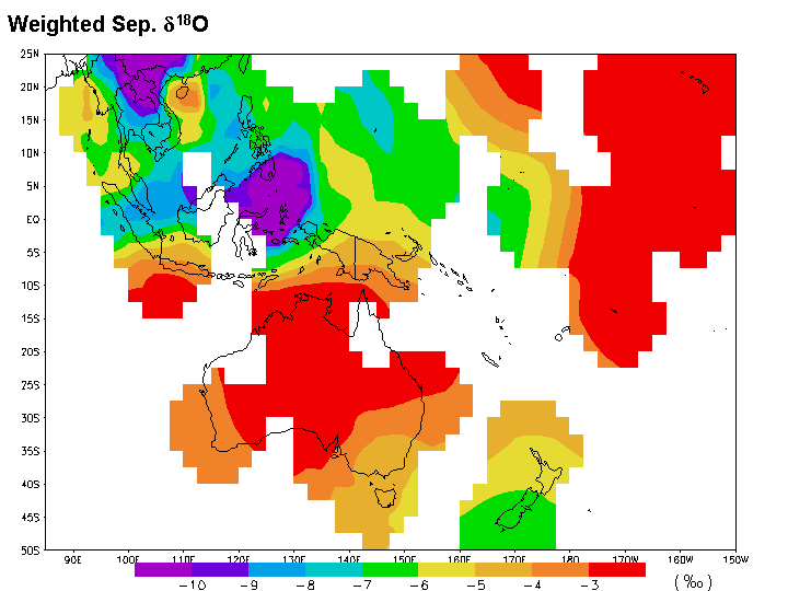
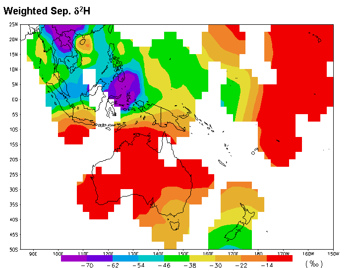
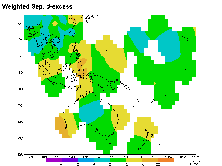
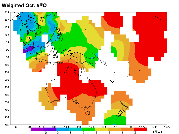
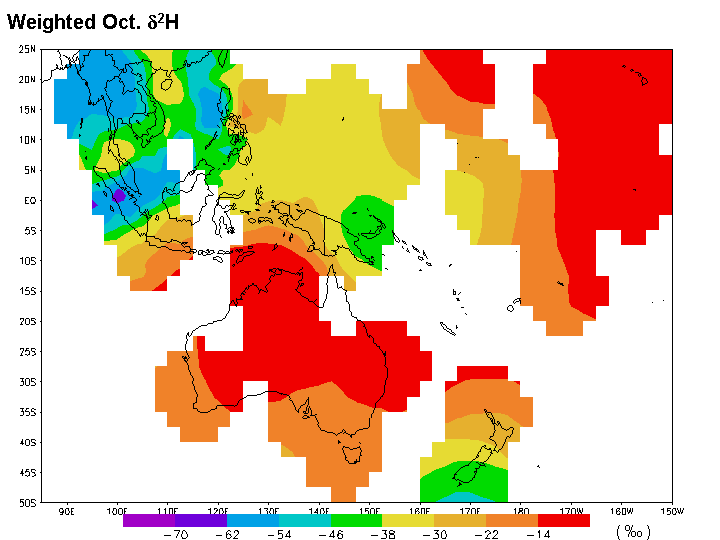
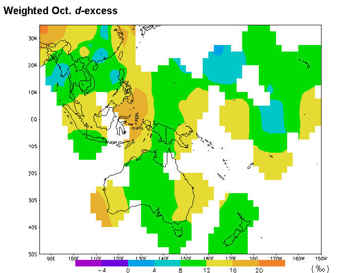
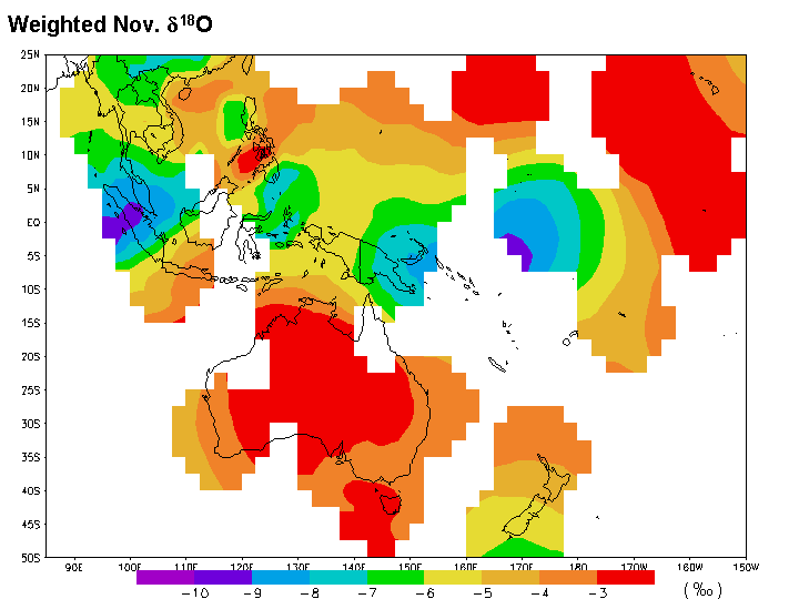
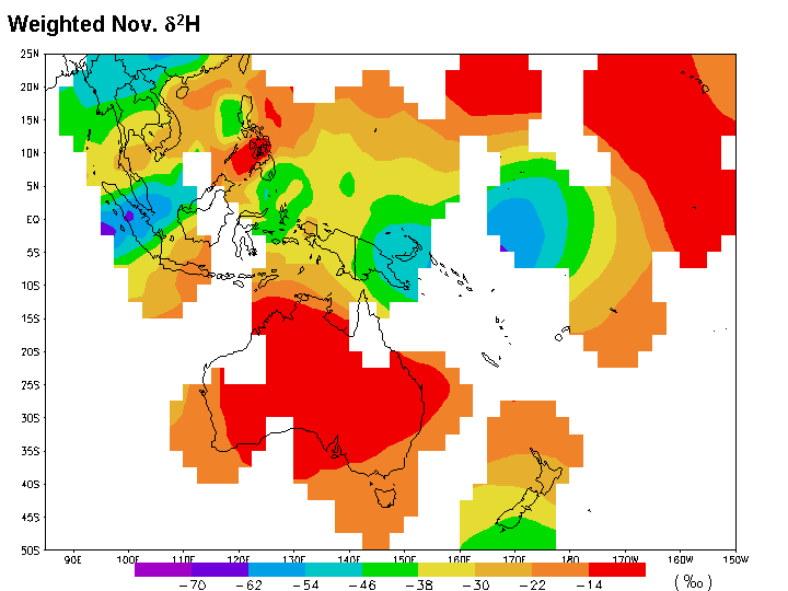
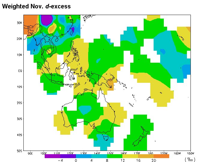
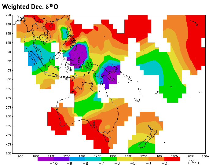
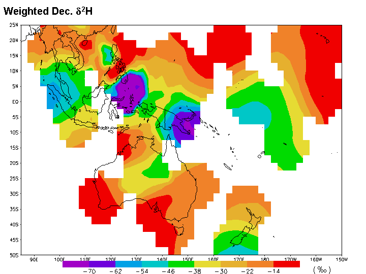
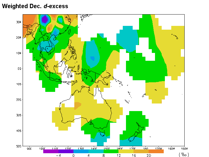
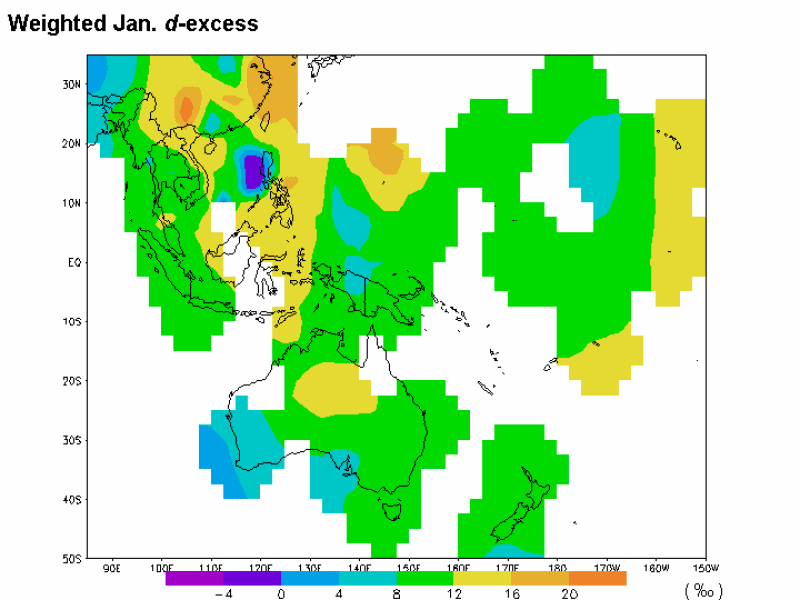
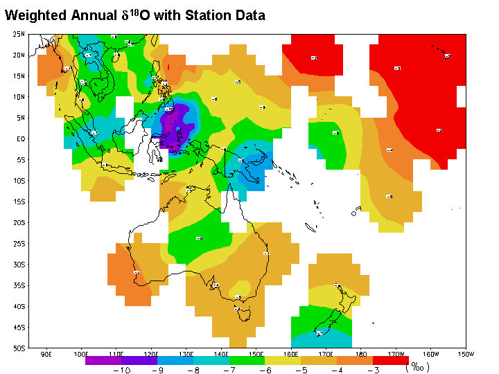
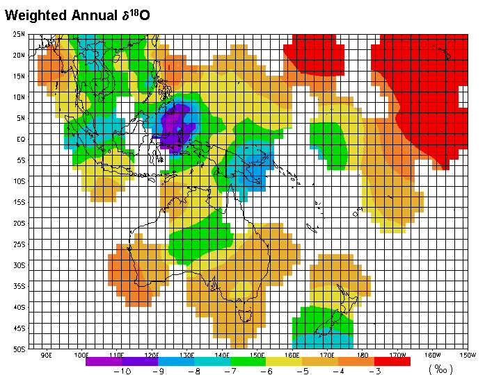
The IAEA has developed these graphical representations of the GNIP stable isotope database to facilitate accessibility and increased use of the data, and to strengthen and improve cross-disciplinary linkages to the network. The graphical representations provide a visual evaluation of the spatial and seasonal variations of isotope data and may be used for reference and teaching purposes. Besides this online-access, a CD-ROM version of this product including Microsoft ™ Powerpoint format presentations is also available from IAEA upon request. The "GNIP Maps and Animations" project is directed by P. Aggarwal and L. Gourcy of the IAEA. Maps and analyses were provided by J. Birks and T. Edwards,University of Waterloo, Canada, under contract from IAEA. Animations were prepared by J. Gibson of the IAEA. Comments and suggestions can be sent to the web site coordinator. GNIP is the IAEA/WMO Global Network for Isotopes in Precipitation managed by the Isotope Hydrology Section of IAEA. Monthly data from 1961 to 1999 can be obtained from the ISOHIS web site. Methodology A joint IAEA/University of Waterloo project was undertaken to develop global and regional maps of stable isotope data from the Global Network for Isotopes in Precipitation (GNIP). The maps and animations are intended as an aid for visualizing the spatial distribution and dynamic nature of the stable isotope composition of precipitation. A graphical GrADS-compatible (GRid Analysis and Display System) version of the GNIP data set was created to produce these maps (interpolation scheme described below) and also to enhance compatibility with the expanding array of grided climate-reanalysis data products. Data Handling: Calculations and Selection Of the 550 GNIP stations in the database, 389 were judged at present to have sufficient monthly composite d18O, d2H and precipitation amount data to calculate amount-weighted annual and monthly means. The GNIP database used in these maps spans 1961-1999, however, data for many stations is available only for part of this period. To improve global coverage, data from all time periods were included in calculation of the long-term means (see Uses and Limitations). The d18O and d2H taken from the GNIP database were amount-weighted according to: where Pi and d i are the monthly precipitation amount (mm) and the isotopic composition (‰), respectively, and n is the number of months. The deuterium excess (d-excess) was first calculated for individual months using: d-excess= d2H - 8 x d18O Note that only consecutive 12 month periods were used in calculating the weighted annual means, omitting additional months which were not part of a complete year to avoid skewing the annual values. Careful attention was given to distinguish between database entries for which isotope information was missing and entries for which precipitation was zero and was therefore not sampled. In the latter case, the annual values were computed based on isotope data in months with precipitation. Weighted monthly means were calculated using all months available, including data from partial years of monitoring. Interpolation of the GNIP station data onto a global grid was performed using a Cressman objective analysis in GrADS (Cressman, 1959). The data were interpolated onto a 2.5° X 2.5° grid (about 278 km X 278 km). In this type of objective analysis multiple passes are made through the grid at subsequently lower radii of influence. "At each pass, a new value is determined for each grid point by arriving at a correction factor for that grid point. This correction factor is determined by looking at each station within the radius of influence from the grid point. For each such station, an error is determined as the difference between the station value and a value arrived by interpolation from the grid to that station. A distance weighted formula is then applied to all such errors within the radius of influence of the grid point to arrive at a correction value for that grid point. The correction factors are applied to all grid points before the next pass is made." (see GRid Analysis and Display System). The radii used in this interpolation were r = 10, 7, 4, 2, 1. Grid points without a station within a radius of 4 grid cells (about 1113 km) were left blank. The maps and animations are based on long-term values computed from the GNIP database. These raw datasets can be obtained in Excel format.
These maps and animations were created to improve our understanding of the spatial distribution and the dynamic seasonal nature of the isotopic composition of precipitation. They were not intended as predictive tools for estimating the composition of precipitation in areas not currently covered by a local GNIP station. Further statistical analysis are required to evaluate the interpolation scheme and the spatial distribution of error in the interpolation. Before using these maps the following limitations should be considered: -The time periods used in calculation of amount-weighted means are variable. As such, the maps presented here are intended to represent climatological means, obtained using all of the isotopic data available for each of the stations. However, not all of the stations were operational during the same time period, so the maps are not based on a consistent time period. As the GNIP database grows, such maps will become possible, but the maps presented here should be viewed as first approximation of climatological means. Note that no effort has been made to normalize the dataset to account for fluctuations or unidirectional changes in isotopic composition at any of the stations over the 1961-1999 period. -A simple interpolation scheme is adopted. The Cresman objective analysis scheme was included in GrADS to provide a "quick-look" feature rather than a rigorous analysis scheme. Given the spacing of the station data points we considered it satisfactory for the present global and regional visualizations. For these maps the radii used in the interpolation were r = 10, 7, 4, 2, 1. Grid points without a station within a radius of 4 grid cells (about 1113 km) were left blank. A rigorous comparison of different interpolation schemes has yet to be conducted. -Unverified local "bulls-eye" anomalies are occasionally observed as a consequence of the interpolation routine in some regional maps. Note that the scales and contour intervals were chosen to highlight the local isotopic distribution. At the scale of some regional maps, bulls-eyes between stations (and usually less than 1 grid cell in area and either angular, thread-like, or irregularly shaped) were found to arise due to shortcomings in the interpolation scheme at these scales. However, regional trends in the data are still clearly visible behind the anomalies. -There are only sparse data in some regions. There are areas where the interpolated isotope distribution likely does not accurately reflect the isotope distribution due to lack of station data especially across areas with extreme elevation changes. For example proper interpolation of the distribution of isotopes in South America along the Andes would require a denser distribution of stations to capture the effect of the elevation gradient. Care should be taken when examining interpolated values in mountainous terrain in general. -Colour schemes and contour intervals vary in selected regional maps to enhance visual trends in areas with subdued isotopic gradients. -The global climatological fields are based on a reanalysis dataset obtained from CDAS. The temperature, precipitable water and 500 mb wind data presented for global time-series are from the CDAS (Climate Data Assimilation System) Reanalysis dataset, using climatological means for 1979-1995. References and Acknowledgements All of the interpolations and all maps were created using
the GrADS software (Copyright © 1988- 1999) developed by Brian Doty, Center for
Ocean-Land-Atmosphere Studies (COLA), Institute of Global Environment and Society,
Calverton, MD. Cressman, G. P., 1959: An operative objetive analysis system. Monthly Weather Review, 87, 367-374. CitingGNIP Maps and
Animations |
Copyright © IAEA/University of Waterloo 2001.
All rights reserved.
|
