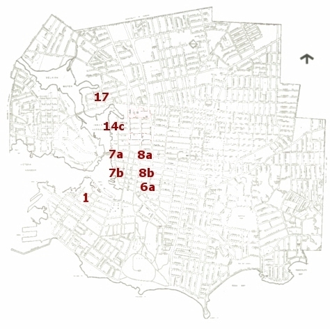
To connect to summary reports on different parts of the city, click on the enumeration sub-district numbers on this image map. The numbers also link to detailed maps of different sections of the city.
The detailed maps are based on a 1902 engineering plan, with a scale of 800 feet to the inch. For this project, the original map was digitally altered and some of the technical data was eliminated. However, the main features of the map have not been changed: The streets and shoreline are exactly as they were, circa 1901.
The original map is held by the City of Victoria Archives [accession B0086]. We are grateful to the Archives for providing a photocopy of the map for this project. The image on the left was adapted from a map published in the City of Victoria Central Area Heritage Conservation Report, 1975.