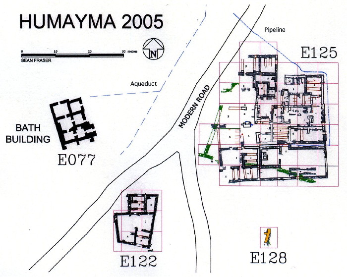
Excavations at al-Humayma (ancient Hawara/Havarra), 2005
Excavation in 2005 continued in the early second-century Roman fort
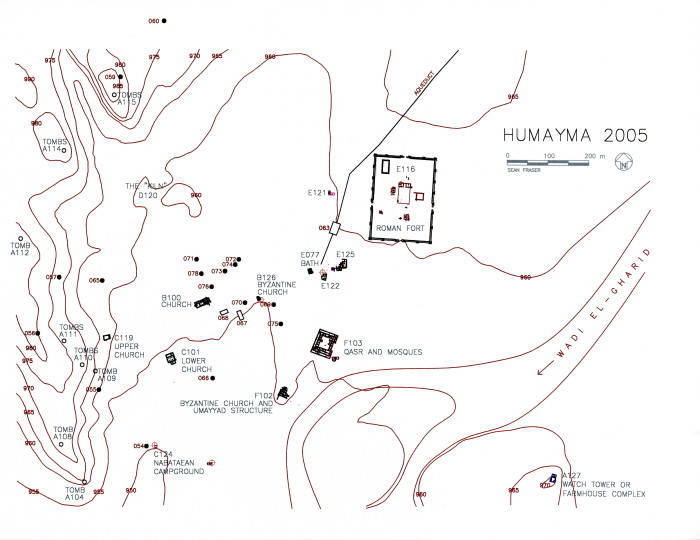
(Field E116) and adjacent civilian habitation and shrine area (Field E125)
(plan of site).
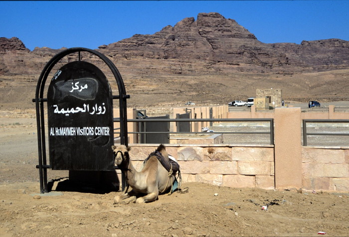
The Department
of Antiquities continued site development for tourism, clearing one of the
Nabataean reservoirs (B068) and beginning the clearing of the exterior face of
the fort walls. A Visitor’s Centre was completed in March 2005 (view of
visitor’s centre).
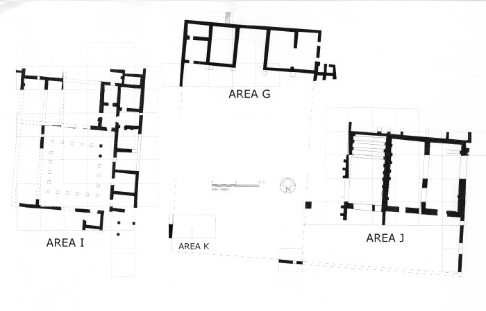
Excavation has been carried out in the fort since 1992. with special
attention on the central buildings since 2000 [Plan of Praetorium (I),
Principia (G), and Horreum (J)].
The Praetorium (Commander’s residence; Area I) clarified the exterior walls of the structure and exposed small rooms on three sides of the central courtyard, possibly fronted by a portico (plan of Praetorium). The courtyard contained a fountain, now lost, fed by a terracotta pipeline from the fort reservoir. Entrances along the south provided access from the Via Principalis, and through a porter’s lodge or a shrine (view of entry area).
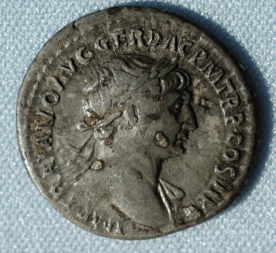
Sandstone piers at the southeast corner of the complex suggest the presence of a colonnade along the Via Principalis; a silver denarius of Trajan was found in this area (RIC no. 291, A.D. 112-117; view of denarius) Modifications to the rooms north and south of the courtyard indicate ongoing maintenance of the second-century structure.
Excavation in the Horreum (Granary; Area J) (see above for plan of Horreum) defined the west exterior wall and exposed another interior wall, proving the division of the central area into three long storage rooms. Buttresses supporting the west wall resemble those of other military granaries (view of buttresses).
A series of collapsed arches and large slabs (arch collapse) indicate that transverse arches supported a flat roof (view of arch collapse).
A large drain extended from the southwest corner of Room A, suggesting that this room, with its brick floor, held liquid stores as well as grain. A wide entrance in the south wall of the three central rooms provided access to the Via Principalis through another series of paved rooms. A paved north-south street, covering a narrow drain, separated the Horreum from the Principia.
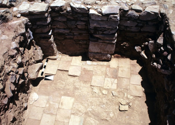
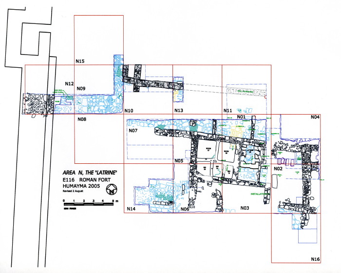
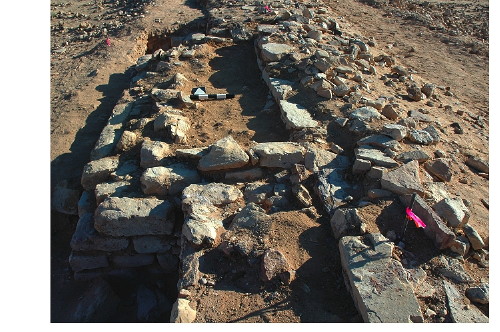
In the southwest quadrant of the fort the limits were defined of the complex containing a latrine and plastered bins (Area N; 5.25 m N/S x 10.65 m E/W; 18 x 36 Roman feet) (plan of Area N).
Well-built walls survived along the east and southeast, while stone pavements bordered the west and north sides (view of Area N).
The east-west street on the north (width c. 4.10 m; 14 Roman feet) bordered another building further north, and a paved intervallum road (width c. 7.98 m; 27 Roman feet) extended west to the inside face of the fortification wall. The visible pavements lie 0.70-0.85 m above the original second-century paving, indicating major renovation of infrastructure during the fourth century, and suggesting reoccupation of the fort by a military unit rather than squatters.
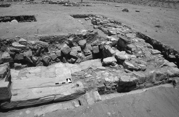
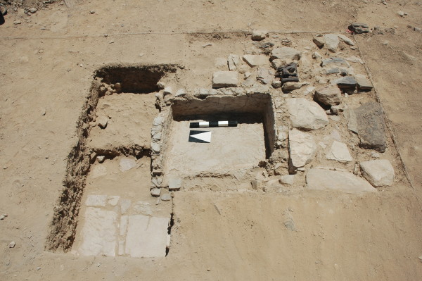
During clearing of the fort walls an irregular, earth-filled platform (Area P; 4.43/4.83 m N/S x 1.65/1.80 m E/W x 1.41 m high) was uncovered 18.25 m (c. 60 Roman feet) north of the southeast corner tower (view of Area P).
Five steps on
the north suggest it provided access to the parapet walk, and reworking of the
fort wall indicate it was part of the fourth-century renovation (view of
platform). A similar structure was subsequently identified just north of the
east gate. It is likely that these platforms were designed to accommodate ballistae (arrow shooters).
Probes of the water system within the fort revealed a series of pipelines and conduits connecting the reservoir with the Praetorium, latrine, and continuing off to the southeast quadrant of the fort. A low basin built on pavement in this area may have served cavalry mounts in a stable, since the installation is inconvenient for human use. Excavation is needed to document the presence of a stable. (view of basin).
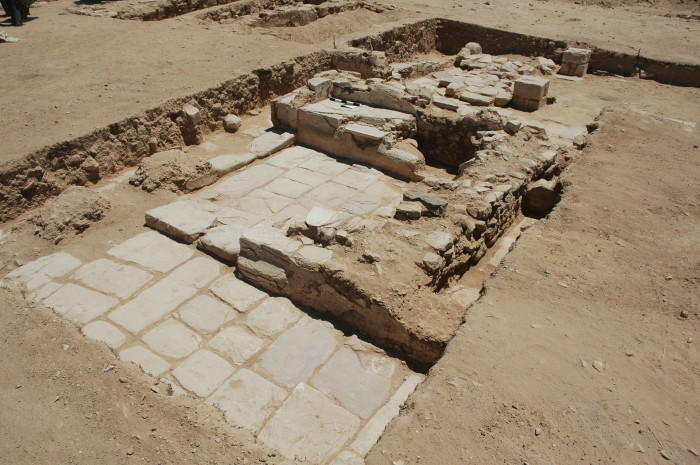
Excavation in the civilian community located outside the Roman fort concentrated on two structures, designated E125 and E128 (plan of E125 and E128).
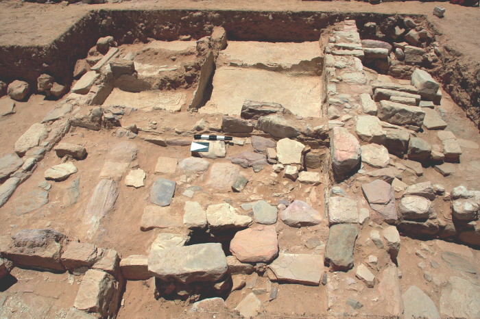
E125 is a large mudbrick complex comprising at least three discrete domestic and religious structures. A one-room shrine fronted by a large walled courtyard was located in the southeast corner of the complex (view of shrine complex).
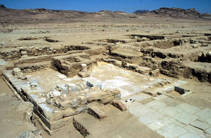
Previous work had exposed a paved processional way running from the door of the courtyard to the door of the shrine, a fixed altar located two-thirds of the way along the processional way, and a pipe-fed water basin positioned just outside the shrine’s door. This season we completed definition of the shrine precinct by excavating north and south of the processional way, revealing two long planters (once filled with flowers or shrubs) flanking the pavement (view of planters). The northern planter probably originally functioned as a corridor but was converted into a planter (by blocking its entranceway) at the same time as the southern planter was built. These two planters provided a symmetrical frame for the Roman period shrine precinct, similar, for example, to the Forum of Peace in Rome.
We also defined the northeast, domestic quarter of the structure, where some of the most complicated phasing in the building was encountered, spanning the first-century BC to the fourth century AD. During the later phases, much of the area was taken up by cooking facilities including several tawabin and the bottom of a basalt grain mill. Much of the western wing of the complex has been lost to stone removal and traffic on the modern road. Excavation of the E125 complex has been completed, and the final publication is in preparation. In 2008, Reeves will continue excavation nearby in Field E128, where probes in 2005 revealed the presence of another mudbrick structure.