Geomatics Technology in Support of Physically Based Modelling
This archive page is still under construction. To be added soon are data (both in situ and remotely sensed data) on the following projects:
- Remotely
sensed images of the foothills of Alberta
including estimates of Leaf Area Index derived
from Landsat and MODIS. This data was in support
of research in forest regeneration. Please see
the thesis of D.M. McAllister and co-authored
publications for more information.
- Remotely
sensed images of Northern Manitoba and spatial
data on snow cover extent. This research was in
support of water resources modelling in Northern
Manitoba. Please see the thesis of S.M.K. Poon
and co-authored publications for more
information.
- In situ data on duff moisture in the foothills of the Rocky Mountains and in Northern Saskatchewan as well as meteorological data and spatial data. This research is in support of the duff moisture modelling efforts leading to duff consumption and information on forest regeneration. Please see LD Raaflaub dissertation and publications.
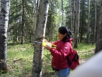
- In situ estimates of forest transpiration and vegetation informatics. This data was collected in support of research on forestry


Contact:
Dr. Caterina
Valeo, PEngProfessor, Mechanical Engineering
University of Victoria
PO Box 1700, STN CSC
Victoria, BC V8W 2Y2
T: (250) 721-8623
valeo@uvic.ca
Adjunct Professor in Civil Engineering, University of Calgary
valeo@ucalgary.ca