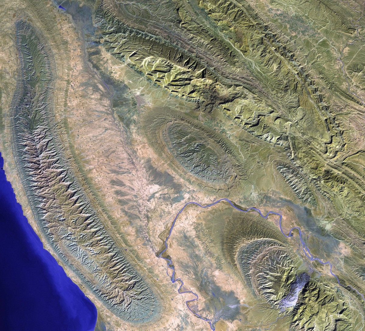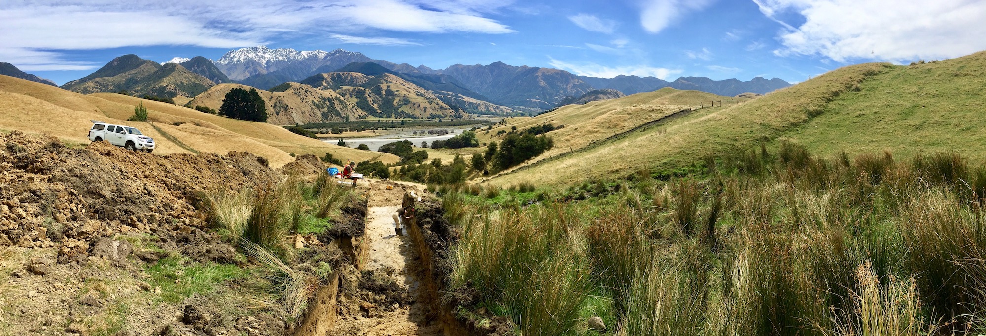
Our research is focused on earthquakes and active tectonics
Earthquakes are amongst the most devastating of natural hazards, and anticipating their locations, timings, and magnitudes is one of the grand challenges of geophysics. Much can be learned by studying the surface expression of earthquake faulting through the twin disciplines of tectonic geodesy (how Earth's surface deforms during or between earthquakes) and geomorphology (how landscapes evolve over many earthquake cycles), which complement the traditional field of instrumental seismology (the study of seismic waves propagating through the earth). We work across these disciplines to better understand the mechanics of deformation from the scale of individual earthquake ruptures to mountain belts and entire plate boundary systems.
Our work is supported by the Natural Sciences and Engineering Research Council of Canada (NSERC), the Canada Foundation for Innovation (CFI), the BC Knowledge Development Fund, the Yukon Geological Survey, Natural Resources Canada, and the Canada Research Chairs program. We are also grateful to Petroleum Experts Ltd. for donating their MOVE software to our lab (equivalent to £1.9M).
Some current topics of focus are listed below:
• Active tectonics along Canada's Pacific margin
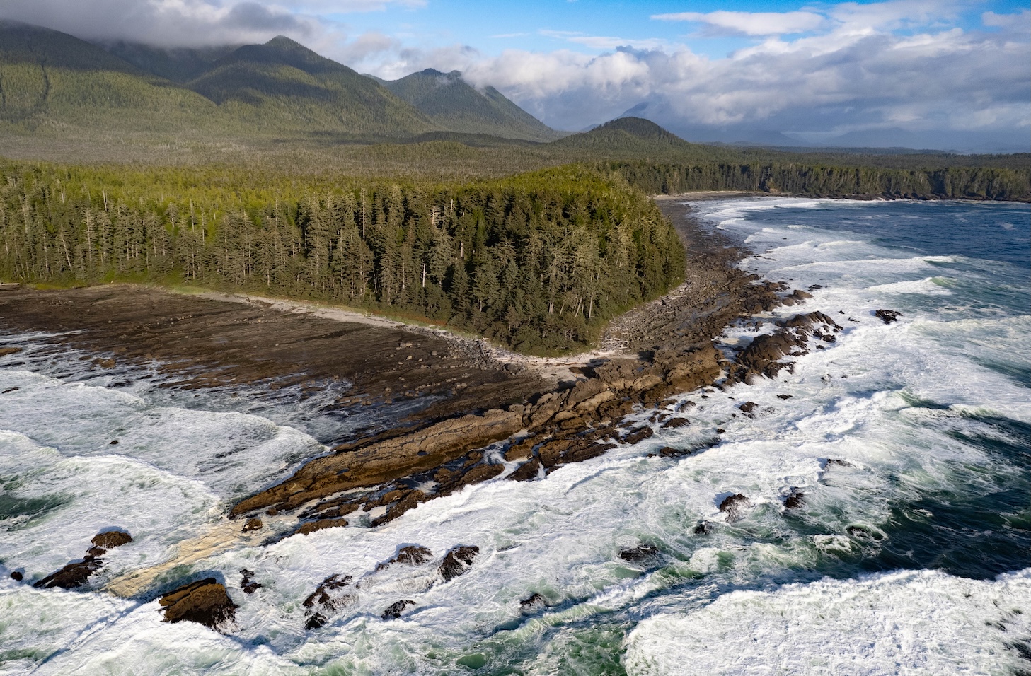
Canada's Pacific coastline is its most important locus of earthquakes and tsunamis. We are using a wealth of new airborne laser scanning (lidar) topographic data to identify crustal faulting on Vancouver Island and examine its role in deformation of the Cascadia subduction zone. We are also deploying state-of-the-art ocean bottom seismometers to assess tectonics of the Explorer microplate, which occupies the transition zone between Cascadia and the Queen Charlotte plate boundary, an ocean-continent transform fault and incipient subduction zone beneath Haida Gwaii.
Example publications:
Oliva et al. (2024): Incipient Subduction and Slip Partitioning at High Obliquity: the Haida Gwaii Plate Boundary. Journal of Geophysical Research: Solid Earth
Harrichhausen et al. (2023): Discovery of an Active Forearc Fault in an Urban Region: Holocene Rupture on the XEOLXELEK-Elk Lake Fault, Victoria, British Columbia, Canada. Tectonics
Harrichhausen et al. (2021): Paleoseismic Trenching Reveals Late Quaternary Kinematics of the Leech River Fault: Implications for Forearc Strain Accumulation in Northern Cascadia. Bulletin of the Seismological Society of America

• Earthquake hazards in the Canadian Cordillera
The Canadian cordillera together with neighboring Alaska and eastern Siberia provide an outstanding natural laboratory in which to examine how terrane assemblages deform under far-field tectonic stresses. Current foci include reassessing the earthquake potential along the Fraser and Rocky Mountain Trench faults in British Columbia, and the Tintina and eastern Denali faults in the Yukon. These major strike-slip faults each accrued tens-to-hundreds of kilometers of offset during the Tertiary, but until now have been generally considered inactive in the Quaternary. Our work challenges this consensus and highlights an important but overlooked risk to infrastructure of national importance including major transportation corridors, pipelines, and hydroelectric reservoirs.
Example publications:
Finley et al. (2025): Large Surface-Rupturing Earthquakes and a >12 kyr, Open Interseismic Interval on the Tintina Fault, Yukon. Geophysical Research Letters
Salomon et al. (2025): The 2020 Mw 6.4 Koryak Highlands earthquake illustrates hidden seismic hazards in the northern Pacific Cordillera. Geophysical Journal International
Gaudreau et al. (2019): The August 2018 Kaktovik earthquakes: active tectonics in northeastern Alaska revealed with InSAR and seismology. Geophysical Research Letters
• Mechanics of large earthquake ruptures
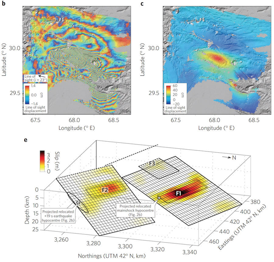
Modern geodetic and seismological imaging tools provide powerful insights into the earthquake rupture process. We have studied the evolution of slip in space and time of several recent, large earthquakes, helping us better understand how slip nucleates, propagates, and is arrested. One of our most interesting observations has been cascading earthquakes that "jump" from fault to fault across wide (~10s of km) gaps, which was not previously thought possible. We are also interested in the role of fault structural maturity in controlling rupture properties including off-fault deformation and shallow slip deficits.
Example publications:
Sethanant et al. (2023): The 2020 Mw 6.5 Monte Cristro Range (Nevada) earthquake: anatomy of a large rupture through a region of highly-distributed faulting. Bulletin of the Seismological Society of America
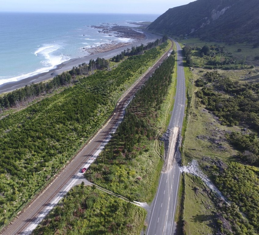
Clark et al. (2017): Highly variable coastal deformation in the 2016 Mw 7.8 Kaikōura earthquake reflects rupture complexity along a transpressional plate boundary. Earth and Planetary Science Letters
Nissen et al. (2016): Limitations of rupture forecasting exposed by instantaneously triggered earthquake doublet. Nature Geoscience
• Uncharacteristic earthquakes
A common assumption in seismic hazard models is that active faults host quasi-periodic 'characteristic earthquakes' (after Schwartz & Coppersmith, 1984) that are limited in length and magnitude by persistent segment boundaries and which supposedly occur at rates higher than implied by the classic Gutenberg-Richter distribution. However, many of our own observations call this into question. For example, we've shown that the Eastern Anatolian fault (in Turkey) involves a mix of single- and multi-segment earthquakes, and that the Papatea and Jordan faults (in New Zealand) ruptured in the 2016 Kaikoura earthquake with different slip, lengths and kinematics than in older events.
Example publications:
Langridge et al. (2023): Late Holocene earthquakes on the Papatea Fault and its role in past earthquake cycles, Marlborough, New Zealand. New Zealand Journal of Geology and Geophysics
Howell et al. (2020): 3D surface displacements during the 2016 Mw 7.8 Kaikōura earthquake (New Zealand) from photogrammetry-derived point clouds. Journal of Geophysical Research: Solid Earth
Pousse-Beltran et al. (2020): The 2020 Mw 6.8 Elazığ (Turkey) earthquake reveals rupture behavior of the East Anatolian Fault. Geophysical Research Letters
• Differential lidar
Repeat high-resolution topographic data offer the capability to map earthquake surface displacements at high spatial resolutions, in three dimensions, and without loss of coherence even amongst steep deformation gradients close to surface faulting. We have developed and are applying these emergent techniques to characterize shallow slip in the first wave of earthquakes spanned by before/after lidar topography, including notable events in Japan, California, and New Zealand.
Example publications:
Diederichs et al. (2019): Unusual kinematics of the Papatea fault (2016 Kaikōura earthquake) suggest anelastic rupture. Science Advances
Lajoie et al. (2019): Extent of low‐angle normal slip in the 2010 El Mayor‐Cucapah (Mexico) earthquake from differential lidar. Journal of Geophysical Research: Solid Earth
Nissen et al. (2012): Three-dimensional surface displacements and rotations from differencing pre- and post-earthquake LiDAR point clouds. Geophysical Research Letters
• Drone lidar for tectonic geomorphology
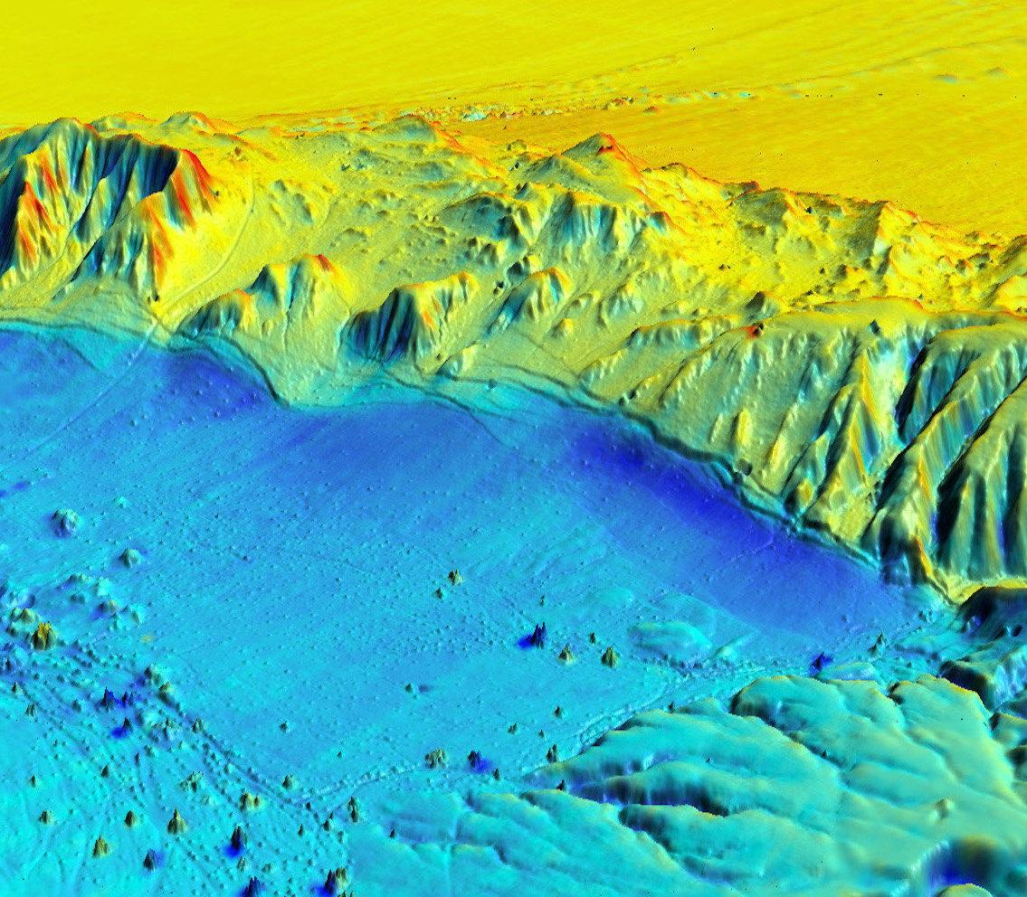
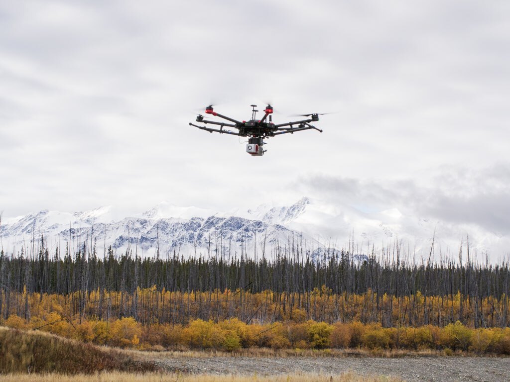
We have developed a state-of-the-art lidar drone system for mapping fault zone topography at centimeter-scale resolutions even in the presence of dense vegetation. The system integrates a RIEGL miniVUX-1UAV laser scanner, an Applanix APX-20 UAV inertial navigation system, and a DJI Matrice 600 hexacopter. We have been trialling it on a number of active faults and landslides across heavily forested BC and the Yukon. The project is funded by the Canada Foundation for Innovation, the BC Knowledge Development Fund, and the Yukon Geological Survey.
Example publication:
Finley et al. (2025): Large Surface-Rupturing Earthquakes and a >12 kyr, Open Interseismic Interval on the Tintina Fault, Yukon. Geophysical Research Letters
Salomon et al. (2024): Mapping fault geomorphology with drone-based lidar. Seismica
Finley et al. (2022): Preliminary results and structural interpretations from drone lidar surveys over the Eastern Denali fault, Yukon.
In: Yukon Exploration and Geology 2021 K.E. MacFarlane (ed.), Yukon Geological Survey
• Earthquakes and active tectonics of the Middle East
Located within the Arabian-Eurasia plate boundary zone, Turkey and Iran contain a dense concentration of large-magnitude earthquakes, including several of the deadliest on record. By studying recent earthquake sequences using high-resolution earthquake relocations, waveform modelling and InSAR, we are investigating continental extensional (Western Turkey) and collisional (Iran) tectonics and patterns of seismicity, aftershocks, and triggering.
Example publications:
Zhao et al. (2025): Variable fault geometry controls the cascading 2023 Herat, Afghanistan multiplet sequence. Nature Communications: Earth and Environment
Nissen et al. (2022): A reappraisal of active tectonics along the Fethiye-Burdur trend, southwestern Turkey. Geophysical Journal International
Nissen et al. (2019): The 12 November 2017 Mw 7.3 Ezgeleh-Sarpolzahab (Iran) earthquake and active tectonics of the Lurestan arc. Journal of Geophysical Research: Solid Earth
