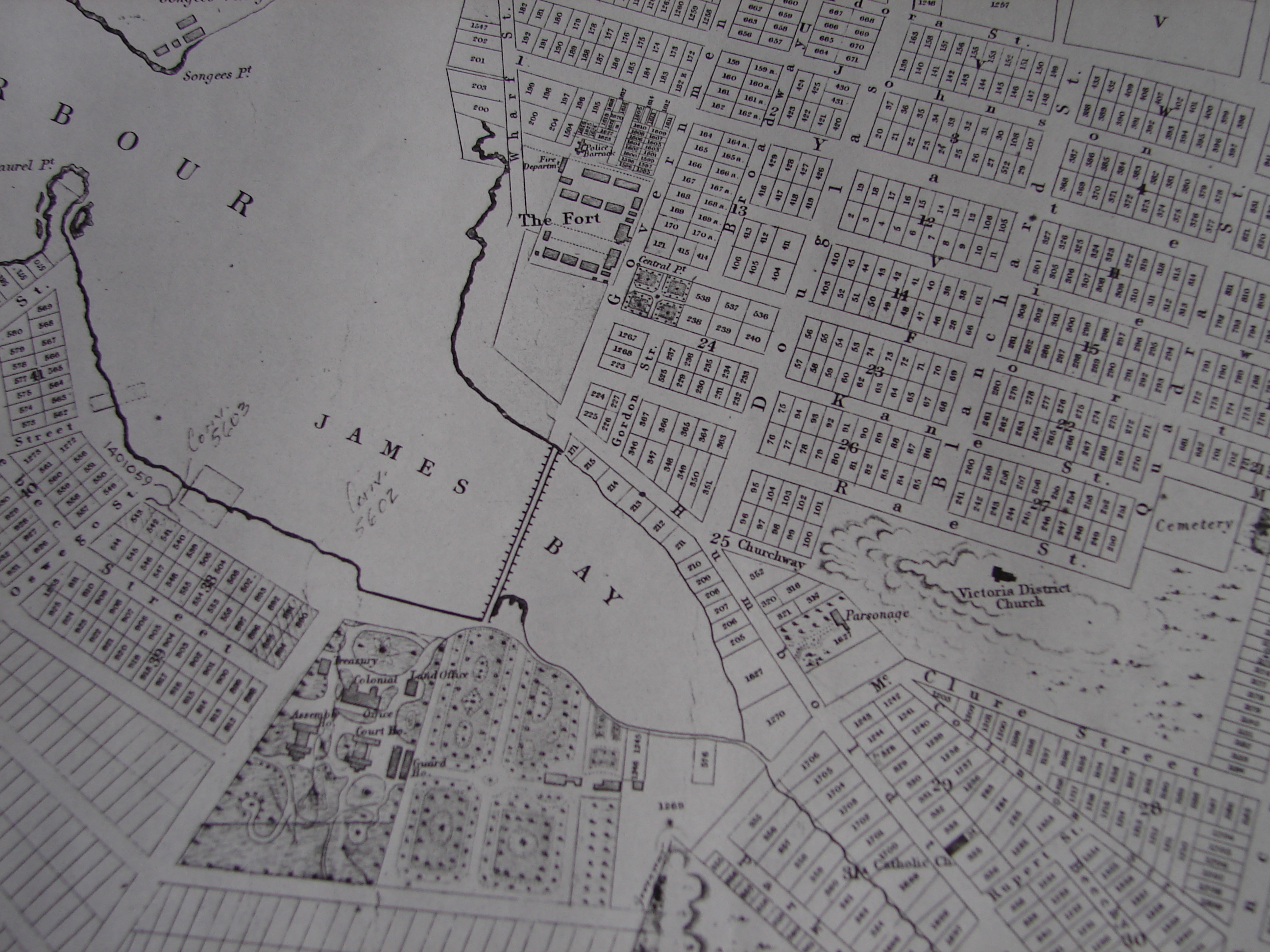
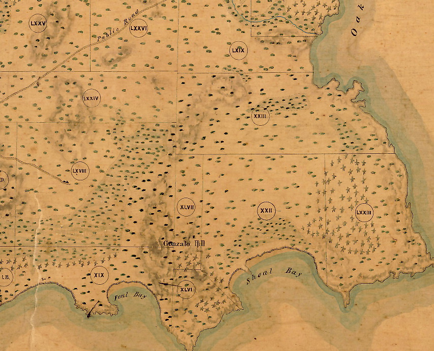
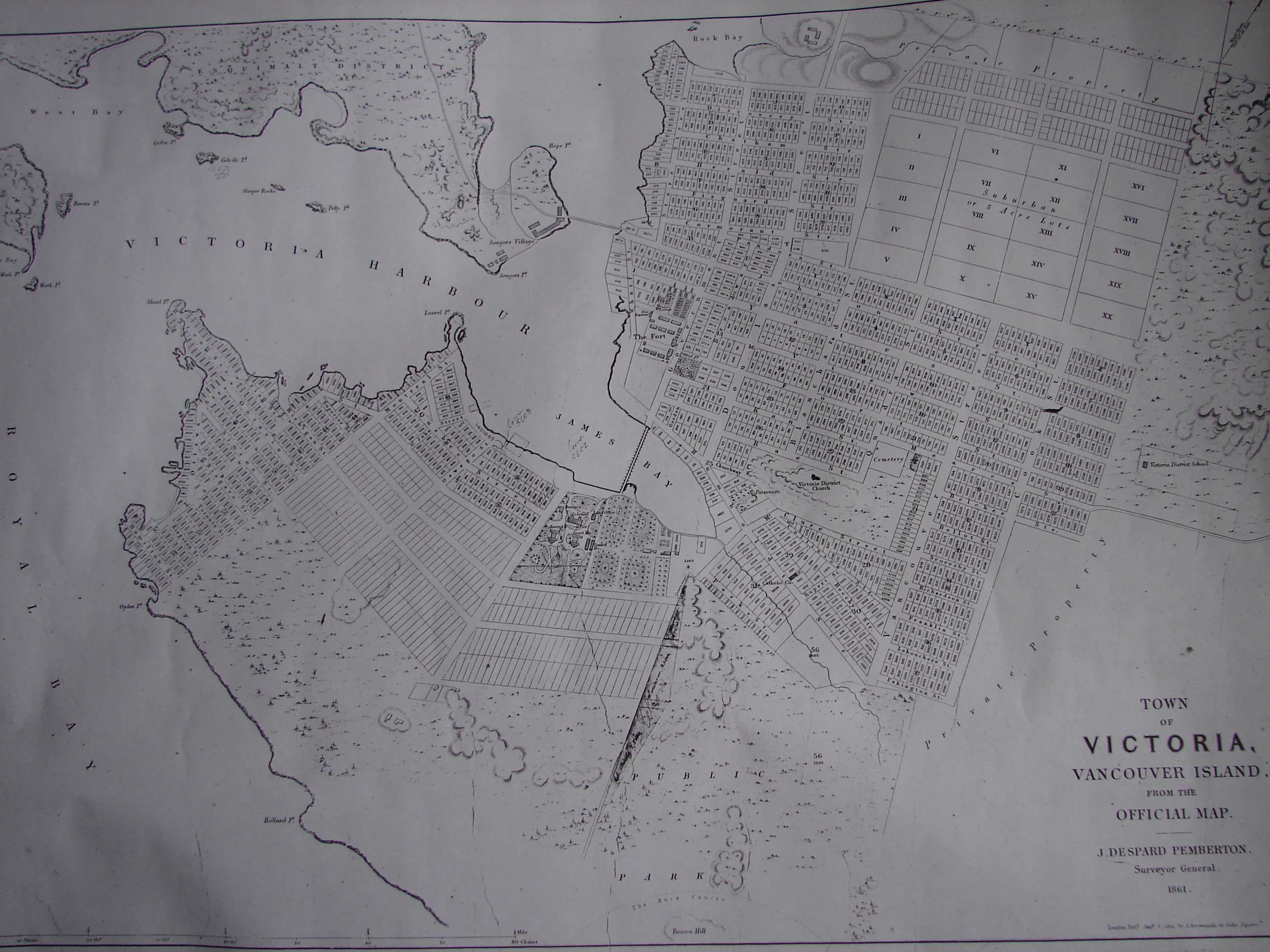
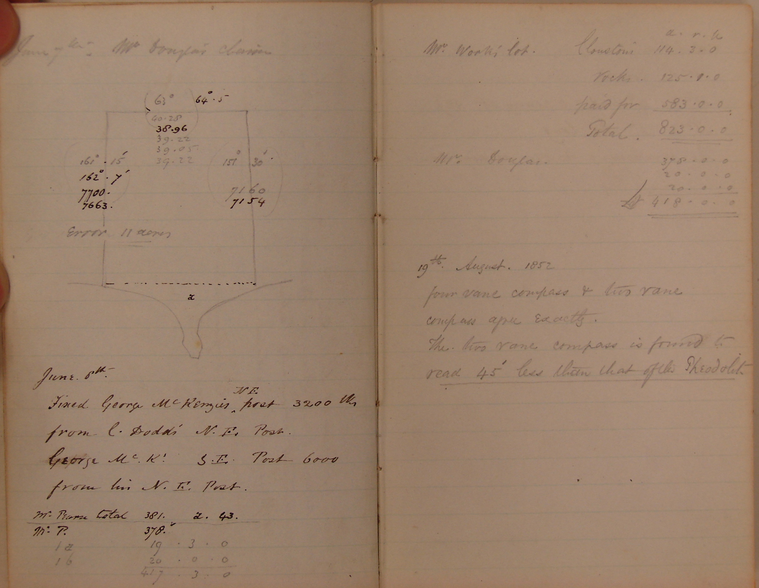
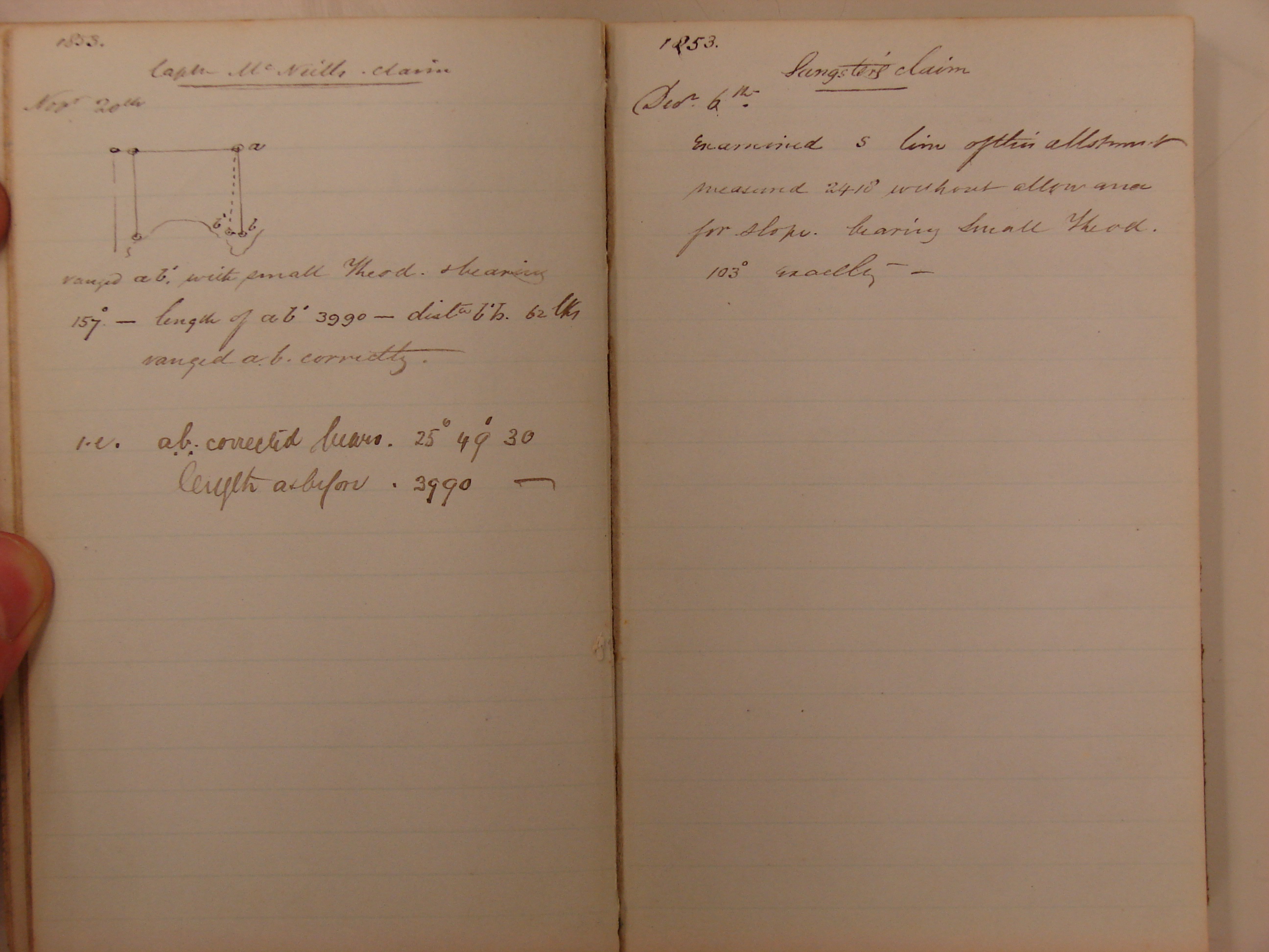
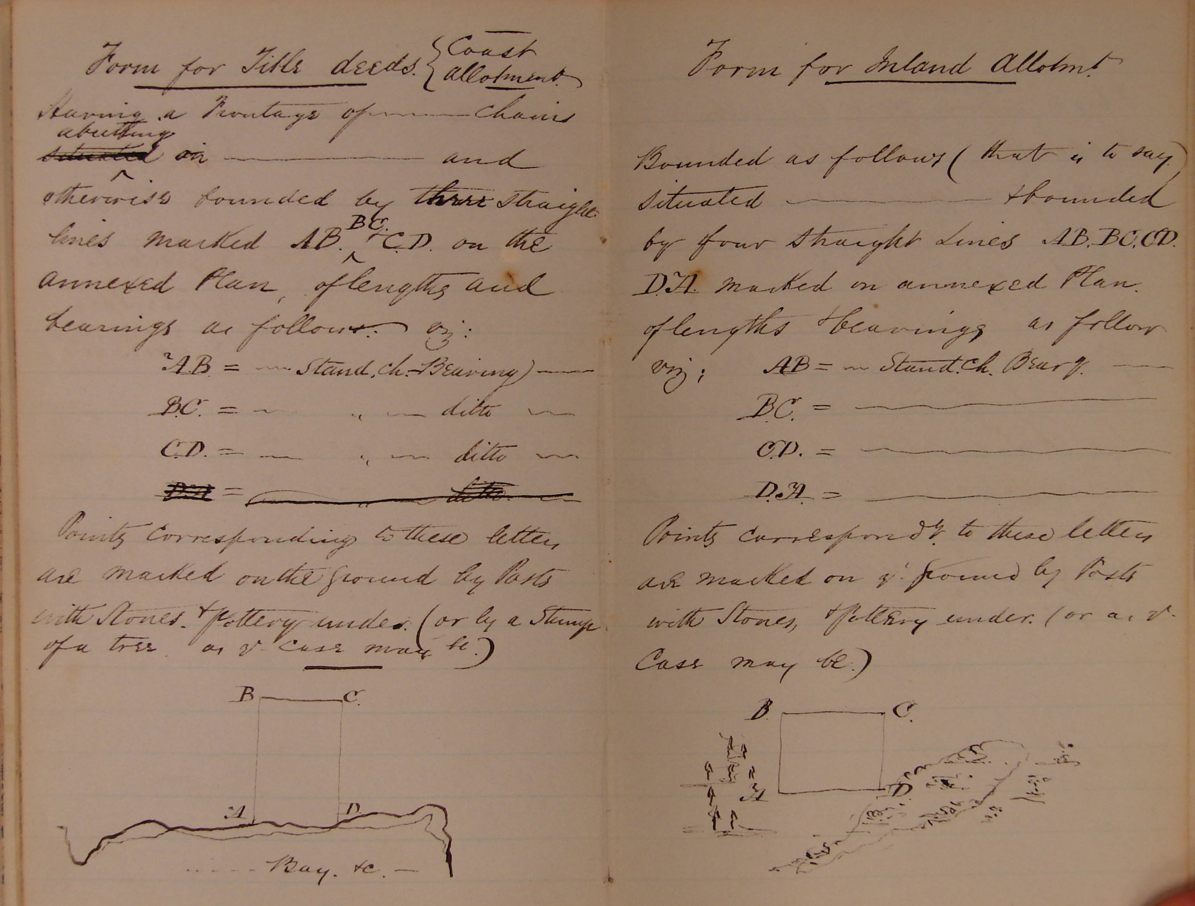
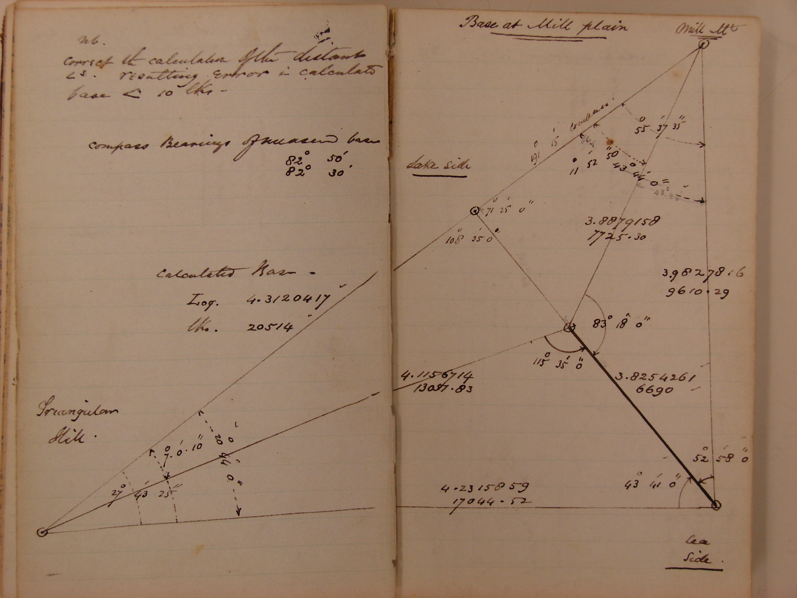
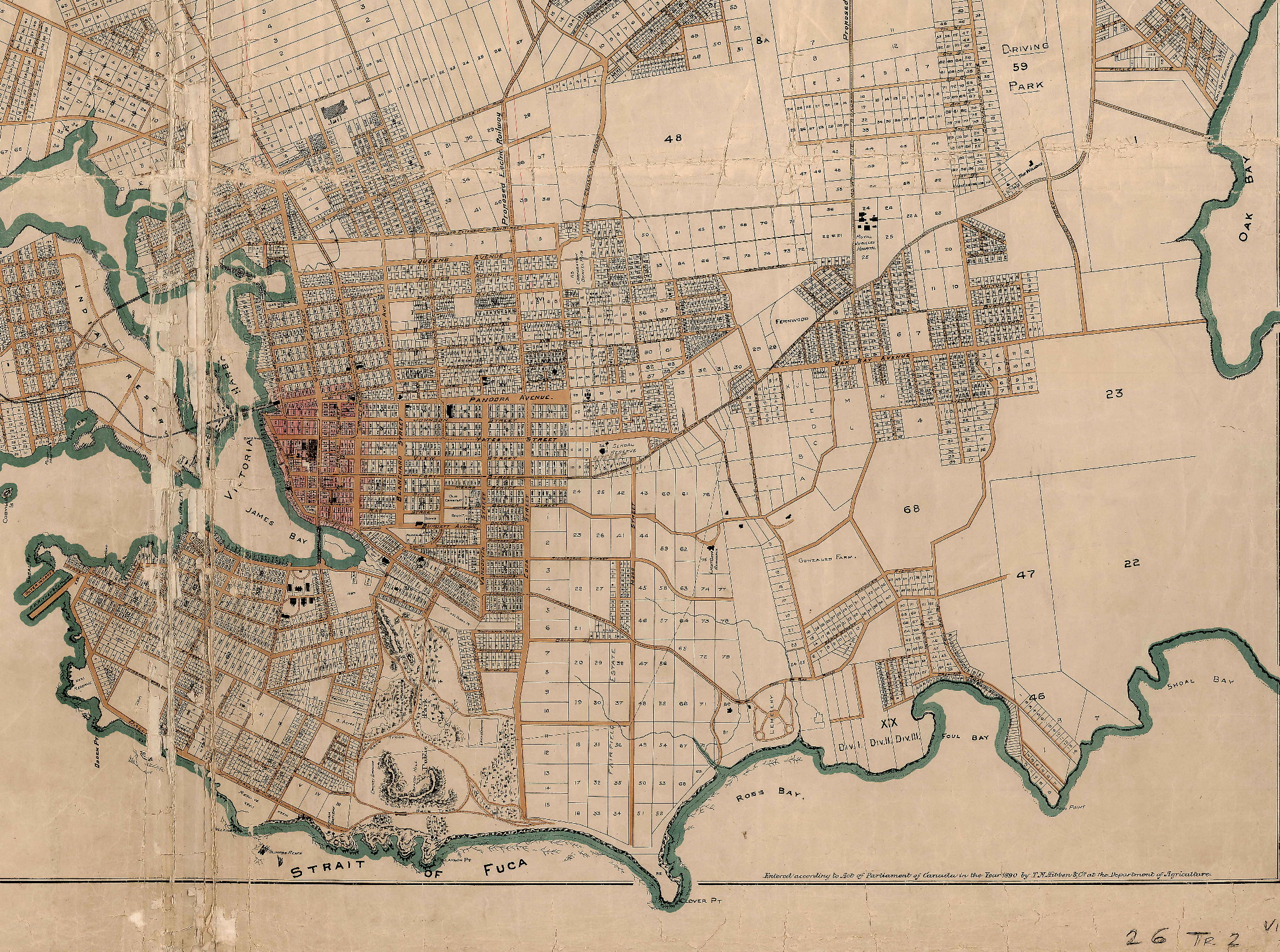
James Bay

Shaping Nature:
The Pemberton Family's Construction of Victoria's Landscape

Home Surveying Gardening Play a Game Sources About Us
Introduction

Surveying and Mapping

J.D. Pemberton and the Surveying of Victoria's Victoria


J.D. Pemberton and Surveying in Victoria's Victoria

Part of Pemberton's role as Surveyor-General of Vancouver Island was to create accurate maps of the island and the land allotments therein.  Click on the thumbnails below to see maps which Pemberton helped draw, as well as sketches taken from his surveying notebook.  Do you see any similarities between his surveying techniques and those used in the rest of the Empire?


Victoria District, c. 1850s Victoria, 1861 James Douglas' Claim
Capt. McNeill's Claim Coast and Inland Allotments Surveying Calculations for Mill Plain
Victoria, 1890