In the “New World” the colonial
administrations had different social conditions to work with when
engaging the surveying of “new”
territory. As Scott argues:
Where the colony was a thinly populated settler-colony, as in North
America or Australia, the obstacles to a thorough, uniform cadastral
grid were minimal. There it was a question less of mapping preexisting
patterns of land use than of surveying parcels of land that would be given
or sold to new arrivals from Europe and of ignoring indigenous peoples
and their common-property regimes. (Scott 49)
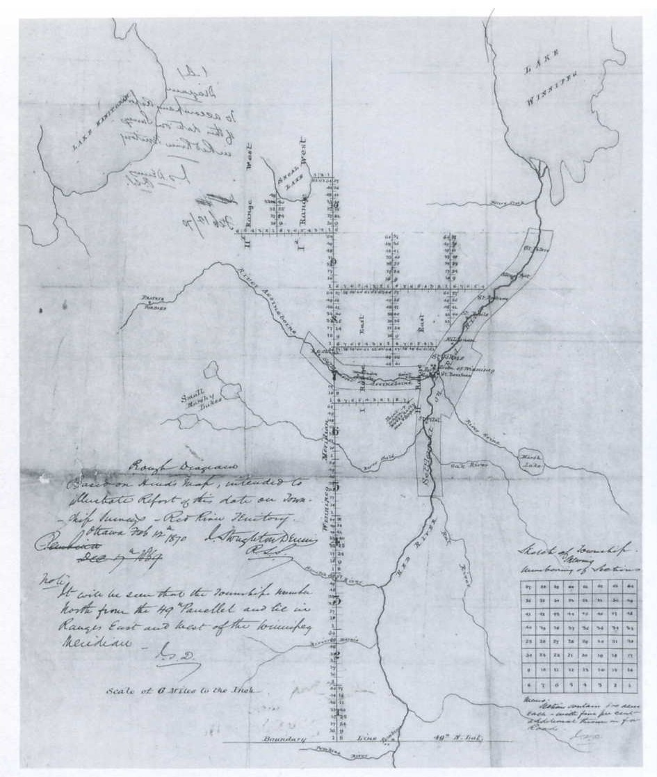
Map of Early Winnipeg
|
In
mapping out new territory, “British” systems of land
holding were often promoted as the desirable forms of settlement. Pat
Moloney shows that “salesmen of colonialization” (Moloney
34), such as Edward Gibbon Wakefield, promoted systems of drawing in
settlers and organizing them on the land as a “systemic”
process (Moloney 35). The Wakefield system’s goal was to
create a productive society that would be based upon not only the
“cultivation of fertile ‘wastelands’ but also the
cultivation of tastes, wants and desires” (Moloney 36).
For Wakefield one way for the promotion and maintenance of Victorian
cultural values in the colonial setting was to offer land, as Moloney
states, “at a uniform price in an organized and equitable way
with the government providing security of title" (Moloney 35).
Thus the state was to have a heavy role in the promotion and
organization of settlement. To accomplish this state officials
would need, as a prerequisite, a firm understanding and knowledge of
the territory they wished to settle. Cadastral mapping provided that
state knowledge.
|
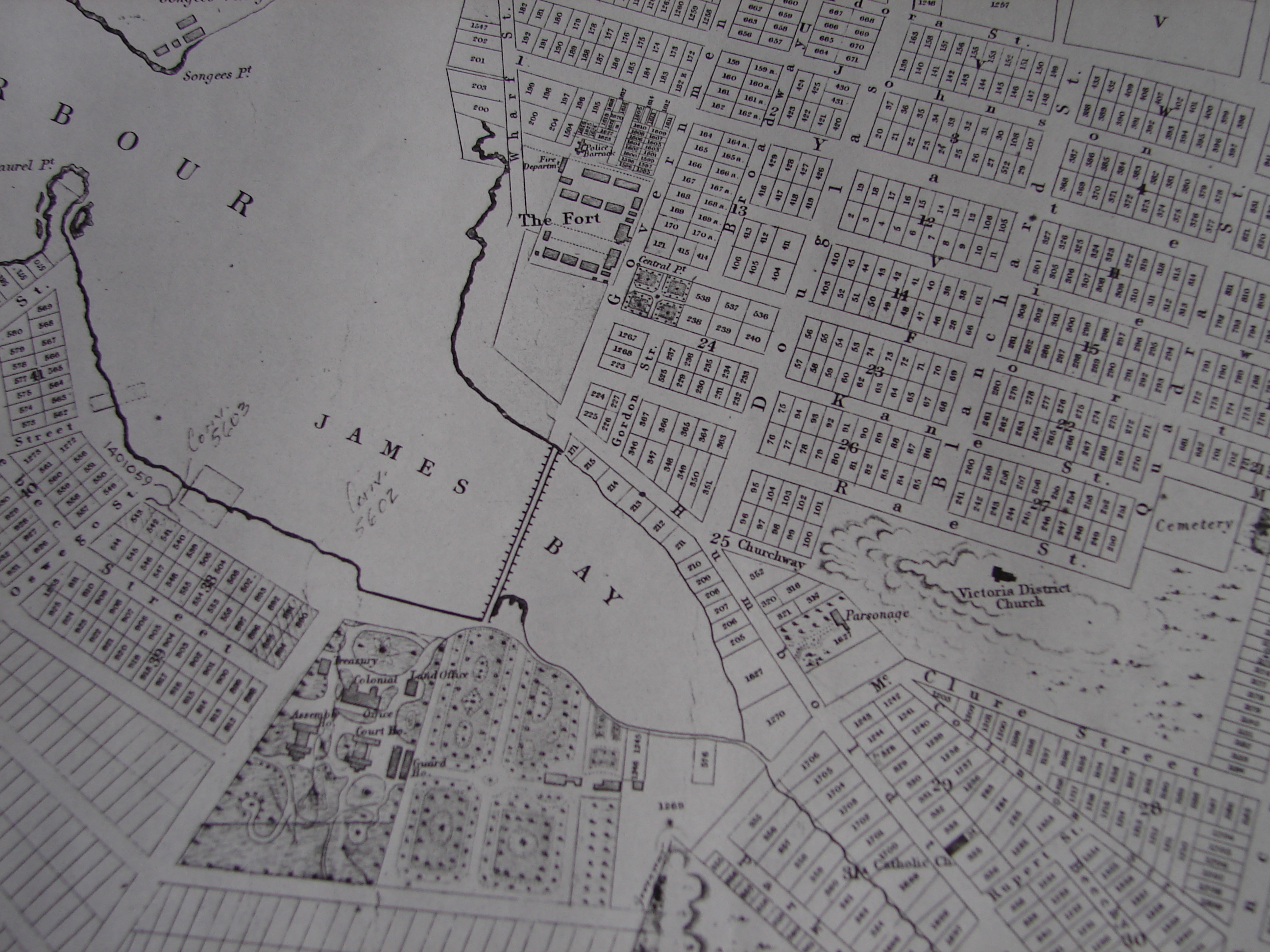
Surveying and Cadastral Mapping in Colonial British Columbia
Cole Harris has provided two examples of how surveying and mapping were
used in British Columbia as tools for the
administration of territory by
the British. The first way in which cadastral mapping and surveying
were used is primarily concerned
with the practicality of securing title to land. For property to be
owned it had to have a specific location, boundaries
and boarders. Maps fulfilled this requirement and were thus a
fundamental aspect of the acquisition of land in a colonial setting
such as west coast (Harris 175).
The second aspect of how colonialism used mapping is related to how
mapping was used to help influence the perception, or using
Scott’s terminology, the “legibility” of a colonial
space for cultural and political means. Harris argues that, “maps
conceptualized unfamiliar space in Eurocentric terms, situating it
within a culture of vision, measurement, and management” (Harris
175). Harris argues that the creation of cadastral maps
re-oriented the colonial administrator/settler’s perception of
space by providing maps as a way to conceive the acquired territory in
a new spatial dimension. Not only did this re-orientation of conceiving
space graft upon the landscape a system that reinforced European
conceptions of property relations, typified by the cadastral
system’s use of grids and carefully measured and numbered parcels
of land, but the cadastral system also enabled settlers to use their
own methods of conceptualizing and administrating space as a way to
replace aboriginal ways of knowing and using the land (Harris 175).
In Harris’ own words, “this cartography introduced a
geographical imaginary that ignored indigenous ways of knowing and
recording space, ways that settlers could not imagine and did not need
as soon as their maps reoriented them after their own fashion”
(Harris 175) Scott is more direct in arguing the same point when
he quotes Kain and Baigent:
The cadastral map is an instrument of control which both reflects
and consolidates the power of those who commission it…the
cadastral map is active: in portraying one reality, as in the settlement
of the new world or in India, it helps obliterate the old. (In Scott 47)
Both Kain/Baigent and Harris’ statements reinforce one of the
prime directives of the Wakefield system, namely, the cultivation of
tastes, wants, and desires; specifically the desire to impose a
European way of looking at, and thus experiencing, the colonial setting.