|
|
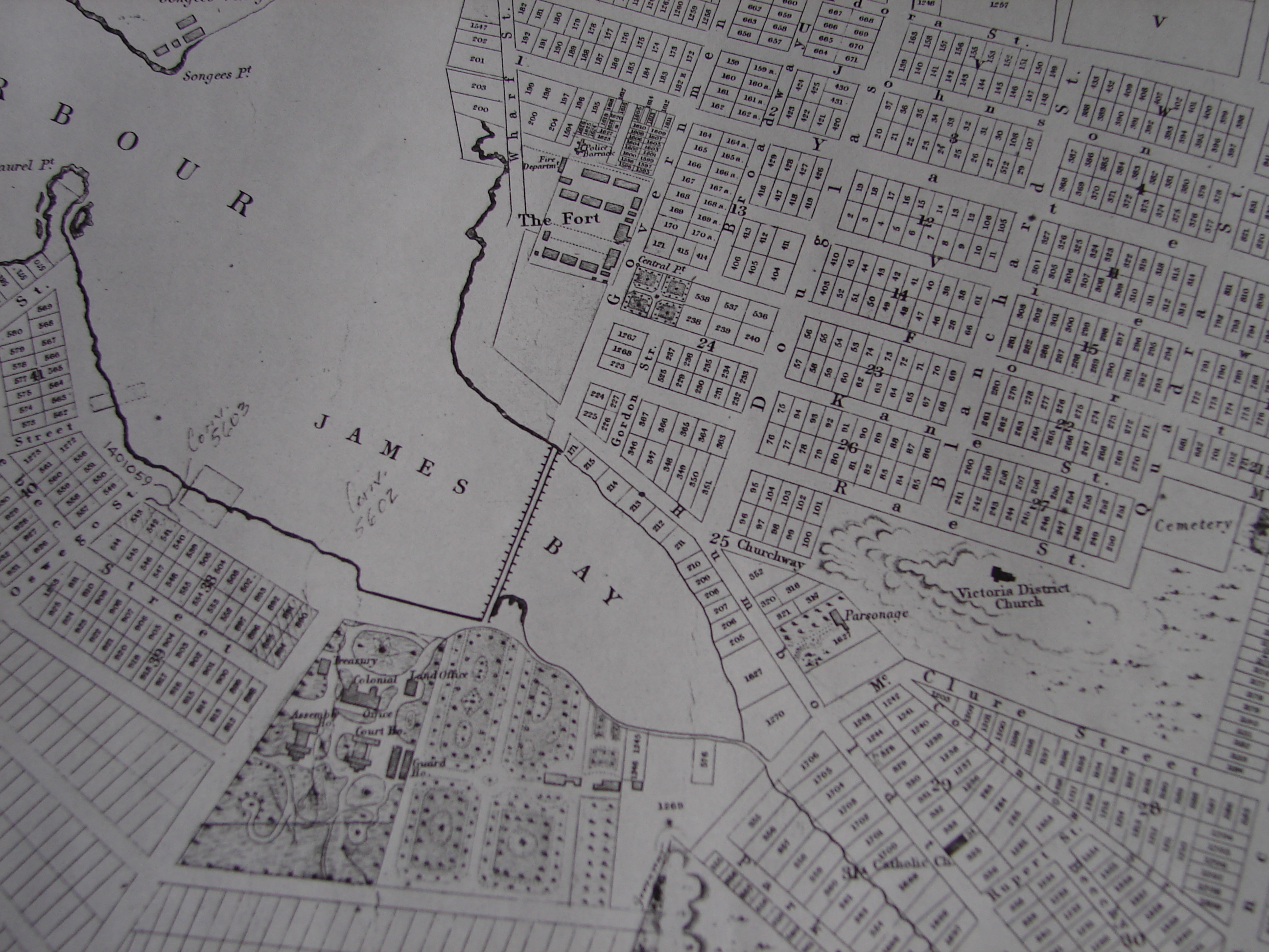
Surveying and Mapping
The
Cadastral map has been
the most commonly adopted technique by professional surveyors who have
wanted to create systems for the management and administration of lands
and property. The cadastral map’s goal is to produce a scaled
down visual representation of all land holdings in a given area (Scott
36). Usually surveyed spaces on the map are numbered. Those
numbered spaces correspond to a property register which lists the
owners of the surveyed sections of property (Scott 36). In
creating a scaled down representation of an areas land holdings, the
surveyor is creating a system whose goal is to
“simplify”
the administration of a given area. Cadastral maps not only
complemented the individualization of property relations that emerged
during the Renaissance, but they also became a powerful tool for the
modern state (Scott 35).
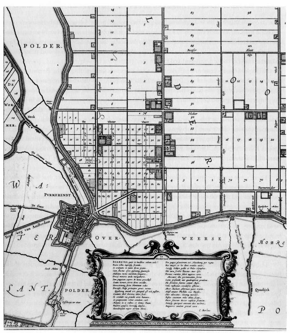
Cadastral Map, 1640.
|
As Scott
argues, “the very concept
of the modern state presupposes a vastly simplified and uniform
property regime
that is legible and hence manipulble from the center” (Scott
35).
What Scott means by this statement is that the centralized
and
standardized
forms of political administration that were increasingly being adapted
as a
common facet of modern political organization necessitated a unified
and
regular system for administrating, and making
“legible” the
“units” that the
state oversaw (Scott 183). To quote
Scott again, “any substantial state intervention in
society…requires the
invention of units that are visible” (Scott 183).
The use of cadastral maps made the
administration of lands more “visible” to state
officials. Scott uses terms
such as “visibility” and
“legibility” as new ways of conceiving how modern
states conceptualized and organized their role in the administration of
their
territory. In their ability influence systems of increased
“visibility” and
“legibility” cadastral maps were excellent tools
for exercising the power the
state over its territory. By creating a visual representation of that
space,
cadastral maps helped to increase a territory’s legibility to
the state, which
in turn allowed the state the means to more effectively know, and hence
exercise power over that territory (Scott 183). The use of
cadastral maps both within Europe and in its colonies provide
further examples of this relationship between cadastral maps and the
exercising
of state power. |
|